Tuesday, December 30, 2008
RUSA 0536 Hood Canal Loop 2.0
2 Degrees above Celsius
That's what the temperature was when we reached the first control at Chimacum. It was cold (obviously), we were wet, and had been riding into the wind. The word "miserable" came to mind. It could be worse ... there could be ice. After stuffing our faces, we headed down the road towards Quilcene. Before we got there ... what did we run into? Not ice, but a bit of slushy snow was falling. Oops!
Fortunately it stopped by the time we hit Quilcene. On the way out of town Joe wanted to stop at the Forest Service office, but the parking lot was covered with ... yes, ice. He decided to wait.
From there we headed up Walker Pass ... would it be snowing? and sitcking? Part way up what do we see but a DOT snowplow coming down. Is that a good sign? Probably not. It is now raining again ... and soon it turns to snow. And now the snowplow comes back, headed up the hill. Definately not a good sign. As we near the top, the snow starts sticking, but fortunately it is pretty slushy and we ride through it. It is cold though! Especially as we ride down the south side.
We soon make it to Brinnon, almost the half-way point. What do we see as we pull into the Tesoro but Vincent! A welcome sight for sure. December 31st, snow along the roads, and we run into a fellow SIR randonneur! We spend a few minutes catching up and then head south together. We ride to Hoodsport, where we refuel, then to Potlatch, where we head our seperate ways ... Vincent to Olympia (end of Olympia-Brinnon ride), Joe & I to Bremerton (end of Hood Canal Loop 2.0).
We are making pretty good time ... close to being able to make the 4:35 ferry. Past Belfair, on the Old Belfair Highway, Joe got a flat. Changing the tire in the cold was tough ... took quite a while. Joe pumps it up and ... it leaks out the valve. Darn. He pumps it up again and ... it holds. We were now at risk of missing the 5:30 ferry. But we hit the road and make the ferry (barely)! We've done it!
Monday, December 29, 2008
RUSA 0531 MI-Redmond-Orting-MI
Guilty as Charged.
I sinned. I rode without a mud flap in winter. Fortunately I did not have to pay for my sins. Chris, Don, and Pam did instead, as they received what the mud flap should have stopped. Chris saved me from further damnation at the first control by giving me his front mud flap to put on my rear fender for the duration of the ride. I have since replaced my missing mud flap, so I am safe from further transgressions (and my fellow riders are safe from me).
Although I had ridden a short Permanent on Saturday, this was my first full Permanent since the snows hit and mostly melted. Having just ridden part of the route, I had a pretty good sense of where the problem areas would be and had arranged detours (where available) for the problem areas that we'd hit in the morning and hoped that the rest of the problem areas would melt by the time we got to them in the afternoon. So after walking part of the East Channel bridge through several inches of slush, we took a several mile detour into Bellevue and the Lake Hills Connector to get over to Factoria ... then another detour just past Eastgate. I knew where I was going on the detour (it wasn't on the route sheet), but forgot to tell Chris until I was about to turn and he was zipping past the turnoff. Oops!
Since this was a pre-ride of sorts, Chris, Don, and Pam were my Guinea Pigs for several of the information control questions. They survived, but not all of the questions did. What had made sense to me didn't always work on the bike.
Don had some great suggestions for route improvements also, so after a brief verification with the route owner, we tested those out and have incorporated those into the current route.
Running low on fuel, we made an unscheduled stop at the Safeway in Kent. Since we had stopped, I stuffed my face with an Orange Chicken Rice Bowl. Why not?
Shortly afterwards, we were almost blinded by a strange bright orb in the sky ... the type rarely seen in Seattle this time of year. It even dried off the pavement, at least in spots. It may have been the distraction of that bright thing, but just before the Orting control we hit a patch of broken glass (Heineken beer bottle). Don hit a big piece ... with a big crunch as he rode over it ... but no damage. Luck was with us.
After a bit more sustenance at the Safeway in Orting, we headed north, with the wind at our tail. We managed to miss the glass this time, but all the grit must have taken its toll, as squeaks were soon heard from several of the bikes. A bit of lubrication and the chorus was quieted.
We hit the Interurban trail and it was clear of snow, at least initially. Patches of snow, slush really, soon appeared, but not bad as long as you were attentive. Then one patch of a deep puddle ...pond? of 4-6 inches deep. Wow. At the end of the Interurban, at the intersection with the River trail, we stopped and put on lights, as it was now dark. Our reward was a gusty rain shower. Then when we got to Fort Dent, the trail was covered with slush. As it was only an inch or so deep, it was rideable ... and fortunately didn't last for long. The next few miles were hit and miss ... clear, then patchy slush ... and then relatively deep slushy snow when we got to E Marginal Way South. It was time to walk the bike and/or take our last detour.
A little more slush to go through before the I-90 bike tunnel and then smooth sailing. A quick ride around the Island and we're done. Pam and Chris get their R-12 ride in! I'm done too. My phone had rung a couple miles from the end. When I return the call from the QFC I get an offer for a ride home. It's only about three miles, but I snap up the offer!
One more ride to go. Three days to get it in. Hood Canal 2.0 on the 31st is it!
Saturday, December 27, 2008
RUSA 0541 MI-MV-Redmond-MI
Yippee!
Back on the road again!
It has warmed up enough and enough snow has melted that I started and finished a Permanent today. Granted it was a shorter Permanent ... 102K, but after a couple weeks of being unable to get much riding in because of the snow, it was great.
I'd tried starting this twice over the past few weeks, most recently yesterday, but it just wasn't doable. Aside from a few short detours (cleared with the route owner, who happened to be easily accessible) and sections that required walking, it was pretty decent riding, generally not slippery. The bike paths were a problem (above), requiring the detours or walking, and then Maxwell Road in Maple Valley was difficult(below). The rest was wonderful.
It wasn't even cold ... there was a sign in Redmond that read 47 degrees.
Did I mention I got to ride my bike today? :)
Monday, December 22, 2008
SNOW rhymes with SLOW and NO
Cabin fever? Not really, but as I want to get three more Permeanents in before the end of the year I'm concerned about running out of time. I'd like to hit 10,000 K of rides in for the year and I'm 450K away. I was going to get 100K in on Saturday, but on my ride to the start I realized that with all the snow /ice I wasn't able to ride fast enough to complete the ride in the alloted time ... so I DNS'd. On the bright side I got most of my Christmas shopping done instead.
Today I thought I'd give it a more complete test and see if I would be fast enough ... and I was not even close. The required minimum average speed is 15Kph, just under 10 mph ... and I averaged 6-7 mph on a 5 mile ride with my studded tires. The roads were either snow packed or plowed with almost complete snow/ice coverage. There were a few places where it was soft slush, but not all that many.
So, too slow ... Permanent soon? No!
Given the conditions & forecast, I don't foresee being able to ride a Permeanent until this weekend and that is still quesitonable. A nice warm rain would be helpful!
Thursday, December 11, 2008
RUSA 0357 Camano Island-Bellingham-Camano Island
Mambo!
Mike Richeson, Mark Thomas, Andy Speier, Will Goss, and I beat the cold & snow to Bellingham today. A great day to ride ... mid 40's and partly cloudy in December! We found a window of opportunity and grabbed it. And when we got to Bellingham, we had a great bonus ... lunch with Dan Turner at the Italian Mambo Cafe. Wow! Couldn't ask for more (couldn't eat any more either, yum!). Only downside was the urge for a nap after lunch. The Scotch Ale seemed to give Mark Thomas a big boost of energy after lunch, but the lasagna really slowed me down.
All that coffee had to go somewhere!
Chuckanut drive had been closed for a month due to a series of four rock slides ... with big rocks the size of trucks. The road opened only two days earlier, but work wasn't quite complete ...
Santa was sighted ... apparently his sleigh was out of commission, so he was testing alternate modes of transportation.
Near La Conner, we ran across a rider with a flat. Apparently he had had several and was running out of patches, and didn't carry any tubes. Have no fear, SIR is here. His tire was changed and he was back in business!
The karma from helping the rider didn't last long ... Andy got a flat in Stanwood. And then Will got a flat 200 yards from the end ... and so he carried his bike over the "finish line".
Saturday, December 6, 2008
RUSA 0400 Deming-Marblemount-Deming
Jackpot!
This ride starts/ends at the Nooksack Casino, and at the end of the ride I hit the jackpot ... a small one anyways. More on that later.
This ride is much like the Three Rivers Cruise - relatively flat (total climbing of 2,700 feet), a ride along SR-9, along the Skagit River, and with a turnaround point at Marblemount. In fact, I ran into three SIR riders at Marblemount who were doing the Three Rivers Cruise - Jack Brace, Ryan Schmid, and Tom Norwood.
The weather turned out much nicer than the forecast, which was for mixed rain/snow and a high of 38 F with a 70 % chance of showers. The roads were wet most of the way and it did shower the last 5 miles or so, but all in all the weather was quite deccent ... it even hit 50F in Sedro Woolley.
The first and last part of the ride between Deming and Sedro Woolley along SR-9 was pretty, especially in the morning with the sun rising. With no shoulders it isn't the most pleasant in the dark when the occasional truck comes by, but the traffic wasn't bad and the views definately made up for it. Aside from the very "fresh" air along a few dairy barns, the crisp cool air was a joy to wake up to.
Riding on SR-20, with wide shoulders most of the way and with the river and mountain views to enjoy was great. I didn't see any eagles along the Skagit, but did see folks out looking for them with their cameras.
Chili at Clark' Cabins just outside Marblemount was good. Really hit the spoot.
Since I parked in te casino parking lot, I felt perhaps I should go in and dro a few quarters in the slot machine as a way to "pay" for the parking. After getting my receipt at the min-mart at the end, I noticed the price at the gas station ... $1.59 ... which was 0.30 lower than anything I'ved seen recently and 0.40 lower than what I filled up at just a couple of days earlier. Jackpot! So I filled up ... after waiting in line. At that price they were very busy.
I guess I still owe them the quarters for parking, as I was distracted and forgot my plan. I suppose it was a small jackpot ... only worth a few bucks, but it felt good and helped justify the lang drive.
Thursday, December 4, 2008
RUSA 0202 Olympia-Brinnon-Olympia
What a gorgeous day!
Okay, a bit chilly perhaps (30F to start out), but come on now. A sunny day in the Pacific Northwest in December? And I'm going to stay inside? I think not.
I've come to realize I am just 1,000K ... 5 rides ... away from 10,000 K for the year. This wasn't a goal. And I don't want to make it a goal per se ... but it would be kinda neat. The catch is there aren't any more Brevets nearby and the Permanents have to be ones I haven't ridden before to count. That limits me to a handful of possibilities ... #202 Olympia - Brinnon - Olympia seems like the choice.
I leave Top Foods at 7 AM, a bit concerned about the possibility of ice, but it turns out to not be an issue. It is a pretty ride along Delphi Rd.
After the first seven or eight miles the ride is along US-101 and the Hood Canal to Brinnon, a small group of houses & businesses. From there it turns around and goes back on 101 to the end at Top Foods. The first/last 15 miles or so of 101 is riding on the shoulder of a divided highway, similar to interstate riding. The ride between Potlatch and Shelton/Olympia is pretty disappointing ... not just the road, but the trash. Not the highlight of the ride, to be sure. I guess it is a necessary evil to be endoured in order to enjoy the ride along the Hood Canal, which is beautiful today ... crisp blue sky and sparkling waters.
I'm getting slightly ahead of myself however, as before I get there I run into a "ROAD CLOSED" sign, with a detour sign right below. This is a few miles north of Potlatch and it is a relatively short detour ... only a couple of miles. As part of it is along a nice wooded road that I hadn't ridden on before, I'm enjoying the detour ... putting aside the lack of shoulders and being forced off the road by a couple of trucks that pass me by.
It is a pretty ride ... the portion along the canal anyway. All things considered, I don't think this is a Permanent that I'd go out of my way to ride again.
Wednesday, November 26, 2008
RUSA 517 - The Alps Inaugural Ride
Vincent Muoneke and I rode the inaugural ride of "The Alps" today. It was going to be the inaugural ride of "The 10K", but since it turns out to have just shy of 9,000 feet of climbing, I had to rename the ride. 9,000 feet was plenty of climbing as it was.
We met at Peet's, across from Whole Foods, so we started off with a warm beverage in our tummies ... nice since it was cold out. We left at 7:09, checking at Whole Foods in case another rider was going to join us.
We were a few minutes behind pace at the first control - Somerset Elementary School. Even though we were at the top of the hill, clouds were coming in ... fog was going to be an issue.
Riding with Vincent was great. This his sixth Permanent this month. Wow. He was in awesome shape and zoomed up the hills. Since he had the original route sheet, which didn't have the info control questions nor the route changes I had made Monday night, he couldn't get too far ahead of me. We got behind a school bus on Newport Way and had to stop three or four times as it stopped to pick up kids. Then up Cougar Mountain, one of the toughest climbs of the ride. We did pretty well on it tough and were back on time by the time we hit the info control towards the top.
The next control was a bit confusing. While just a four way stop, an intersection of two roads right? Wrong - there six road names ...lots of different road signs (133rd Ave, 134th Ave, 72nd Place, Newcastle Way, Newcastle - Coal Creek Way, & Newcastle Golf Club Road). How did that happen?
We don't figure that out. From there it is off towards Renton. Part way down 148th Vincent stops ahead of me and picks up a SIR mud flap ... it was probably mine from Monday's ride, as I had the mud flap last week and don't have it now. Well, that was fortuitous.
Down towards the Maple Valley Highway and then a turn onto Jones Road. Another nice road find from the Issaquah Populaire. Foggy though. Pretty too.
We zipped down the Auburn-Black Diamond Road and then up the Green River Valley. More fog.
Out of the valley up to Black Diamond and then up Tiger Mountain. No fog though ... gorgeous blue sky. From there it was on to Squak Mountain (a nice little 500 foot addition to the ride since Monday). Then up Highland Drive and over to the Snoqualmie Valley ... what fog again? Thick fog. Fortunately Vincent's Garmin beeps as he reaches the Issaquah-Fall City turnoff ... as otherwise we might not have even seen it.
And now for the ultimate climb ... we head up Lake Alice Road. This climb had a maximium grade of 24 % when I rode it a few weeks ago. While I doubt it really has changed, my Garmin read a maximum of 32 % as I rode up. Ouch! I had plenty of time to read it as I ground my way up. As the turn-off came into sight I saw Vincent pedaling onward and upward ...I yelled, but he didn't stop. Since there isn't another way out (well, not an easy one anyway), I figured I could sit and wait, but then decided I'd ride up and find him ... it was only another 100 feet of climbing. He was at the intersection at the top, getting directions from a car that had stopped. We went back down and then through the path to Snoqualmie Ridge.
Food. We were both hungry when we got to the Shell station at Snoqualmie Ridge. I had a corn dog ... hit the spot. It was starting to get dark now, so we didn't stay long. I wanted to make it down the descent to Fall City while there was still some light. With darkness falling, heading into the misty fog again, the ride along 203 was not pleasant. The mist kept collecting on my glasses, which magnified the headlights of the oncoming cars, making it difficult to see. A few miles down 203 there was a deep grate on a bridge that I barely missed. It was a relief to turn off 203 and climb Tolt Hill.
As this part of the ride was new from Monday, I was looking for a good place for the information control ... fortunately we found a spot near the top that had a street light ... much easier to have an information control when you have light. After a climb up Lake Ames Road and the last information control, it was over Union Hill Road and back to Whole Foods.
We made it in 11 hours and 40 minutes. 8,800 feet of climbing. My legs felt like rubber. A piece of pizza and I felt somewhat renewed ... at least I know had enough energy to make it home for dinner.
Monday, November 24, 2008
RUSA 517 The 10K ... or not
I was psyched. The 10K ride was approved! This was going to be a great winter training ride .... lots and lots and lots of climbing, yet a maximum elevation of only about 1,100 feet. I had sent an invite to the SIR list for the inaugural ride of the 10K on Wednesday, but needed to pre-ride it to make sure the route sheet was a-okay and, most importantly, to come up with the information control questions.
I started from Peet's Coffee at 6:30. The ride starts gently, going through Marymoor Park and then going down the east side of Lake Sammamish. At the south end of the Lake I was warmed up and ready for some climbing. Up to Eastgate and then up to Somerset. Nice views here of Lake Washington, Mercer Island, etc. No time for enjoying the views though. I am barely within the control time limits. Okay, they don't apply to information controls, so it isn't absolutely critical at this point, but I need to stay on time so that when they do count, at a regular control, I'm within the limit. I come up with a couple of information control questions and hit the road.
Now for a downhill portion ... down to Newport Way and then along Newport Way to the base of Cougar Mountain. I hadn't ridden up Cougar Mountain until the Issaquah 100K Populaire ... the inspiration for this ride. It is a great climb. So up I went. It was close to a 1,000 feet of climbing, with much of it in the 10-15 % grade range and a max of around 20%. By the top I was definitely warmed up.
Even though I was hot, the way down would be cold, so I bundled up and headed down Lakemont to Newcastle. Chilly yes, but a restful change. Before turning onto Coal Creek Parkway it was time for another Information Control ... a few minutes to spare now. The sun was out and it seemed to be warming up a bit.
No more big hills for a while, so I had the chance to put some time in the bank. I headed off. By the time I got to May Valley Road my hands were freezing ... it was much colder in this valley. Time to put my gloves back on ... what had I been thinking?
Up a modest hill, 148th Ave SE, into Renton and over to Jones Road by the Maple Valley Highway. Jones Road was a nice alternative to the Maple Valley Highway...rural, windy, and scenic. It was then time to cross the Maple Valley Highway and head up 196th Avenue. I had never been along this road before - found it on the King County Bike Map. It is a nice road to ride on ... a bit more climbing than I had expected, but then that's what this ride is all about!
By the time I reached the first real control on the Auburn-Black Diamond Road, I had about half an hour in the bank. However, it was beginning to look like the ride wouldn't hit 10,000 feet of climbing ... so I started thinking of how I could tweak the course to get some more climbing in. But from here it was a nice long, gentle descent towards Auburn and the start of the Green River Valley. Very enjoyable. And from there the ride up the Green River Valley is one of the best. So picturesque !The climb up out of the valley towards 169 and Black Diamond was gone in a flash. A climb yes, but no killer grades here.
Lots of rolling hills and then a real climb up Tiger Mountain to the Fire Station. No need for a 911 call here, the climb is very doable. A nice descent to Issaquah and time for a climbing check ... 5,000 feet so far. I now expect the ride will be only 7,500 feet ... how did it get to be so far shorter than the projected 10,000? Oh well. I figure I can add perhaps a 1,000 feet with a few teaks - up Squak Mountain, over Tolt Hill Road, offset by shortening the ride in a couple of other places.
But before that, I have to make it up the next set of hills ... up Highland Drive and then probably the toughest climb of the day ... Lake Alice. I ride up Highland Drive ... on the road, not the bike path, just to check it out. I decide the bike path is better. Can't get the bike to shift into the smallest gear in the front though ... that is a disappointment as I work my way slowly up Lake Alice Road. Still doable though. It is quite a relief to make it to the top ... only one real climb left - Union Hill Road.
By the time I make it to the last info control at Lake Ames & W Snoqualmie Vally Road, it is just starting to get dark. The ride to the end is pretty straightforward except for the routing through the Park & Ride lot. Not sure how that got in there ... but simple enough to take out. I make it to the end just before 5:30 ... just under 11 hours. Not bad. 7,700 feet of climbing. I guess I'll have to rename the route, as I can't get it to 10,000 feet of climbing unless I make major changes. Should be able to get close to 9,000 feet with some minor tweaks though.
Now hopefully I can recover enough to ride it again day after tomorrow!
Tuesday, November 18, 2008
RUSA 083: Why would anyone
... in their right mind ride across the Hood Canal Bridge? Sure, if you look at the scenery from the bridge it is wonderful, but who can look at it? The "shoulders" are minimal to non-existent on either end, there is the gap in the middle of the bridge that is great at grabbing tires, and then there are the metal grates on either end and in the middle. While you can avoid the grates by riding on the very edge of the road, the covering on the metal plates has worn off in large chunks ... so not much better than the grates, but okay as long as you keep it totally straight. Not easy to do with a semi blaring by and the metal plates banging. It is a stressful experience. And on this ride (RUSA 83, Hood Canal North) you get to do it twice !!
A screw loose, not playing with a full deck, bonkers ... but that is what I did today. At least it wasn't foggy when I crossed it today.
On the other hand if I had ridden the Hood Canal Loop and only crossed the bridge once today I would have ended up in Bremerton ... where the ferry terminal was closed due to a bomb threat. So this must have been the right choice.
Rational thought was not my strong suit today. Or was it? On the way back I convinced myself that it was better to take it easy, stop and get something to eat, than push it a bit and catch an earlier ferry. So I missed the 4:35 ferry by 2-3 minutes and was able to ride "easy" the last 3 hours and stop at McDonalds because it made more sense?
I must have fallen out of bed and hit my head last night!
Wednesday, October 22, 2008
RUSA 203 Hood Canal Loop
Sunny and 71 in late October. It was a great day to be out on the bike. Steve Davis, Albert Meerscheidt, Thai Nguyen, Eamon Stanley and I got up well before the roosters crowed and caught the 6:10 AM ferry to Bainbridge to do the Hood Canal Loop.
Billed as a ride to control the symptoms that have led to several mid-week sick-day rides for ailing SIR members, I for one can state it was succesful. I did not realize however, that my symptoms would be replaced by sore, tired legs brought on by a sub-9 hour ride. While the five of us rode together for the first stretch of the ride to Suquamish, shortly thereafter we split into two groups. Eamon must have had a burr on his saddle, as he was riding fast. Thai seemed to have no trouble keeping up, but I kept dropping off the back. Fortunately a few construction zones, with stops by the flaggers provided me the opportunity to catch up. However, by Shelton, I was done. After a quick stop, Eamon went on while Thai and I took the opportunity to refuel with a bite to eat.
We did catch up with Eamon neear the Grapeview info control ... which was no longer there. So I came up with a new question for the next riders.
While it was cold to start and there was fog along the Hood Canal Bridge, the rest of the ride was clear and sunny, with temperatures quite comfortable. Although the reading was a bit suspect, the sign in Belfair read 71 as we rode by in the middle of the afternoon.
Thai, Eamon, and I reached the end by 3:40, with time to enjoy a sausage & beer at Fritz' before the 4:15 ferry. Alfred and Steve had a more sane ride and caught the 6:40 ferry.
Saturday, October 18, 2008
RUSA 085 Three Rivers Cruise
A gorgeous fall day, great riding companions, and a wonderful bike route! Could one ask for more? Why? It was even a leisurely start. Don Boothby had sent out a notice for a Sat ride of the Three Rivers Cruise with a 8:00 AM start at the Haggen store in Arlington. Don, Thai Nguyen, Chris Heg, Mike Richeson, new RUSA member Pam Creighton, and I hit the road right at 8:00. Shan Perera got a few extra minutes of sleep and caught up with us on the road.
There was a bit of fog to start off with, but the sun was blazing through the clouds before we were able to make to Darrington. Darrington ... at 575 feet we had reached the summit of our ride ... pretty tough riding :) ... well, a good enough reason to stop and refuel. Soon we were off ... except Thai stayed to wait for Shan.
From Darrington the ride was picture perfect ... a crisp fall morning with lots of sun. The gentle downhill made for nice riding and we soon made it to Marblemount. We took the back way to Marblemount ... exploring a minor route adjustment to avoid the out & back section on 20 ... and it received favorable reviews!
Also receiving good reviews were the soups at lunch. A couple of miles west of Marblemount we stopped for lunch - soup & pie. I had chile & onions. It hit the spot.
Now for that after lunch siesta ... well, maybe next time.
The ride from Marblemount to Concrete on SR-20 was generally pretty nice. Most of the time the rumble strips were a nice addition, but there were a few instances where the construction crews must have been asleep on the machine. To the right was one example where there is no way that this could be within specifications. Arghh!
Well, once we got past Concrete the rumble strips were behind us and it was chip seal instead. It actually wasn't too bad as it was fairly old so it had been packed down. Still, the riding surface on SR-9 was a welcome change. Mike and I rode ahead of the others at this point. Towards the south end of Big Lake there was a serious accident ... two fire trucks, two aid cars, and a rescue truck were all at the scene. As we past, a police unit arrived and must have closed the road. Don, Pam, Chris, Shan, and Thai all had to backtrack and ride around the other side of the lake. Six bonus miles! Mike and I reached the end at 5 ... we had a tailgate party waiting for the others to pull in shortly after 6.
A nice day!
Thursday, September 18, 2008
RUSA 320 Mountain Loop Highway
Thursday ... not normally a long riding day, but the weather was going to be nice and the calendar was clear, so why not. The ride started in Snoqualmie and I took the counter-clockwise route. In retrospect, I think the clockwise approach is better, as that has the advantage of having the unpaved portion as a climb rather than a descent. I suspect that would be faster, at least for me, as I took it slow on the descent to stay in control on the dirt portion.
Not going to say much about the ride other than it was very enjoyable ... very little traffic on the Mountain Loop Highway and lots of greenery, mountains, and river views.
Sunday, September 14, 2008
Mountain 600K: They're Miserable Dad!
My daughter Jessica and I helped Ryan out at the Naches overnight control on the Mountain 600K this weekend. In addition to it being a nice time together I had hoped that she would get to understand a bit of the Rando experience … my family tends to think I’m a bit nuts and thought this might help give me some slack. So after the Control closed and we were in the car, I was curious about her observations. When she said “They’re miserable, Dad!” I went into denial.
Well, yes, they’re exhausted, physically drained, and some are in pain … feet, butt, muscles – there was a run on Ibuprofen…and I suppose many appear mentally wiped … some are almost catatonic, dazed. And yes, we’ve had at least three riders taken to the hospital on long brevets this year, including one at this overnight. So perhaps they appear miserable, but they’re not really … I’m not when I ride … or am I? Are we miserable? Why do we do this to ourselves? Is it “because it feels so good when we stop (well, not right away)?.”
I don’t think so.
I ride these long brevets because of the challenge – both physical and mental – and the adventure. I ride because of the beauty I get to see. I ride because of the camaraderie – the shared experiences, such as the ditch nap or Post Office snooze. I ride because it makes me feel good – in spite of the pain. I ride because it’s fun – and being a bit miserable is probably part of that in a perverse way. So, yes, I suppose they are miserable, but loving it!
Sunday, September 7, 2008
100K Mountain Populaire
The word Mountain in the name is a clue about this ride. While it doesn't really go up into the Mountains (i.e. Cascades or Olympics), it explores the "Issaquah Alps" ... the local hills such as Cougar Mountain and Tiger Mountain. There is plenty of climbing even though the maximum elevation is only about 1,200 feet. I had never ridden on a few of these roads ... they've inspired me to create a new Permanent "The 10 K" with lots of climbing over these hills and a few others.
It was a very enjoyable, albeit tiring ride!
Thanks Kent!
It was a very enjoyable, albeit tiring ride!
Thanks Kent!
Sunday, August 31, 2008
Mountain 600K Pre-ride: All Creatures Great and Small
I pre-rode the Mountain 600K ride this Saturday and Sunday. Jan Heine and Ryan Hamilton put together what was billed as a "fitting finale to a season that carried the motto "Return to the Mountains"" and that "will challenge all riders". Seeing the course ... up to Paradise on Mt. Rainier (5,400 feet), up to Windy Ridge on Mt. St. Helens (4,035 feet), up White Pass (4,500 feet) , and up Chinook Pass (5,438 feet) ... it was clear they were succesful. The question was, was I up to the challenge? Could I do it within the 40 hour time limit?
I left Eatonville at 4:00 AM. I was well rested, having gone to bed at 5:30 PM, getting up at 2:00 AM. It was cool, but I was well dressed. A new pair of AmFib tights had arrived Friday afternoon, just in time for the ride ... they were warm and wind/rain proof, so I didn't need to bring rain pants. They turned out to be well worth the price.
I was doing the ride solo, but 45 minutes into the ride I had company. A car rode along side with the driver, a young woman, asking me what I was doing, where I was going, etc. After a few minutes, she left, but ten - fifteen minutes later she pulled up again, wanting to know more details. She stopped the car and, after a brief conversation, I took off again. Another ten - fifteen minutes and she showed up again ... promising she wasn't stalking me! Another brief conversation and I left. Fortunately a little later the route took a side road, Mt. Tahoma Canyon Road, so if she was still looking for me she didn't find me!
The first control of the ride was at the Paradise Visitor Center - 5,400 feet up. It had been misting for the past several miles and was foggy. I rode up to the entrance and ... it was closed. It was just after 8:00 AM and the sign said they opened at 10:00. Not a good sign. I tried the door and it was open. Actually, they were open ... at least the climbing desk was ... the store/visitor center part didn't open till 10:00. That was fine with me. I was soon on my way.
The ride down from Paradise was chilly and wet. A badger (or something like that) ran across my path, yipping all the way, less than a mile from the top. After the long climb up I was a bit disappointed that I couldn't let it rip on the way down, but the scenery was so beautiful that I enjoyed it anyway.
Before I knew it, it was a little after 10:00 and I was in Packwood. Along with everyone else. They were having Packwood Days or something like that. There were booths up and down US-12 and lots of folks out for the day. One advantage of that was the Shell station had someone outside making sure no one parked there without going to the store. I made a snap decision and had him sign the card and left without getting any supplies ... the next control was only 16 miles away.
At Randle, the next control, I resupplied and prepared for the climb up to Windy Ridge on Mt. St Helens, 33 miles ahead. The past thirty miles had been basically downhill, but now the tables were turned and it was uphill. Between the change in grade and the warming of the day, it was time to take off the tights and jacket. Ten miles from the control was the turn to FR-26 ... but there was a sign saying the road was closed due to washout 14 miles ahead. Oh shucks! I knew that FR-99 (the last road to Windy Ridge) was closed to cars, but the route sheet doesn't say anything about this. I wasn't about to ride 14 miles uphill just to find out if it was passable or not. Since the planned route was to go up FR-26, join FR-99 to Windy Ridge, then come back via FR-99 and FR-25, I decided to go up FR-25 and then hopefully find a ranger or someone to find out if 26 was passable. So up I went.
While I have seen pictures of Mt. St Helens before, I had never been there. Pictures don't do it justice. The power that was unleashed to wipe out the miles and miles of trees must have been amazing. It was nice to have miles of road closed to cars, but the condition of the road precluded letting it rip on the downhills - there were periodic cracks in the road, boulders, landslides, etc. I made it to Windy Ridge by about 3:30 PM. It was windy (maybe that's where the name comes from), and there were threatening clouds, so I took a couple pictures and left.
I did run into a few bikers and asked them if 26 was passable ... they said it was, so I headed that way. They were right. I was able to make it through, but there were several patches of gravel, bushes overgrowing the already narrow road, and one complete washout. The picture shows the washout, taken towards the way the riders will be coming from. For them it will be at the bottom of a downhill, so hopefully they will take it easy on the way down so they can stop in time! After that the roads were better, albeit with a few short patches of gravel, and I was rolling down the mountain ... enjoying the scenery and the grade!
I rolled into Packwood again at 7:00 PM. I was just about half-way done ... two of the four climbs and 180 of the 380 miles done. Sunset was just before 8 and it was going to be sixty some miles over White Pass with no services until the next control. So I ate a sub sandwhich, called home to check in, prepared my second bottle of multi-hour Sustained Energy, and got ready for night time riding. Forty-five minutes later, I headed out.
A few miles outside of town I saw a pair of elk alongside the road. They stared at me as I stopped and took a picture ... which only shows a pair of eyes and an outline of the two ... oh well, it was dusk after all. Then the climbing started. On the Cascade 1200, when I climbed White Pass in the 90 degree heat, I had to stop several times. Tonight was not nearly so bad ... not as hot, for sure. It was a slow and steady climb. The sky was clear and the stars vivid. What a wonderful opportunity to be here! Several times I saw little field mice running along the road, caught in my bike light. When I finally made it to the top, while I had been comfortably warm, I soon chilled. I put on my hat, gloves, and the tights back on. Just after the top I startled a skunk ...it was less than ten feet away from me with its business end pointed at me. As we left each other's company, I sniffed ... did it spray me? If it did, it must have missed me due to the wind. That's a relief!
In seven miles is one of the turns that is easy to miss ... and at this point I had turned off my Garmin GPS as it was just about at the end of the regular battery life. I've made this turn before, but it wasn't dark then. I figured by watching the mileposts I could estimate where it would be and would be okay. I found it and then turned on the GPS to confirm. Dead battery, so I went to the backup battery charger ... which has to be connected while it charges, so isn't a great setup, as I don't have it charging on the bike mount, but in the bento bag. Still, I was able to use it periodically over the next twelve miles of winding roads to confirm I was on the right one. Being in the middle of the mountains, in the middle of the night, in the cold, it was very reassuring.
Soon I was back on US-12 with a clear cut route down the mountain to the next control in Naches. The question was would there be anything open? While I probably had enough food and water to go through, it would be better to resupply and would be nice to rest a bit ... it was another eighty miles or so to the next confirmed set of services in Greenwater.
I pulled into Naches just after 2 AM and there was an open Shell Station mini-mart. They even had some bananas - no chairs though. I resupplied and asked if there was a Post Office nearby ... there was just a few blocks away on 3rd street. So I headed there and went inside. Warmth! The wind was howling outside, but I was able to sit and rest for a bit on a bench. Didn't sleep, but refreshing nonetheless. Eatonville wasn't getting any closer as I sat there, so at 3 AM I decided it was time to go. I had caught myself wanting to drift off a couple of times before Naches, so I took a caffeine pill to guard against nodding off while I was riding.
The route out of town was along the back roads, and on a couple of gravel roads (which will be changed for the regular ride). The howling wind, which had helped push me the last few miles into Naches, was no help as I headed back into the mountains. It didn't stop me, but did blow me to the side a few times. Fortunately it didn't blow for all that long - ten miles or so at most - and I was able to make steady progress.
Dawn soon arrived. I made it to the Shell station at Cliffdell at 5:45 AM, but they didn't open until 6:00 AM, so I continued on. It was only 27 miles to the top of Chinook Pass, but I didn't get there till 9:00 AM. Aside from the last five miles, it was relatively easy riding - not fast, but very enjoyable. A few deer saw me and then bounded away. Wish I had their energy! The last five miles or so were tiring ... not that they were all that steep, but steeper and it was the fourth major climb and my legs let me know it. Fortunately there were only four major climbs and soon that was history! At the top there were a few snowflakes and then the descent.
After a few miles of descending I had cold rain in my face, but that only lasted twenty minutes or so and I was able to make steady progress. At Greenwater it was time (past time!) for a good breakfast, so I pulled into Buzzy's Cafe and had a great breakfast of bacon, eggs, and hash browns. Really hit the spot. Left there about 11:30.
A monsoon shower struck when I got to Buckly. What a downpour! Glad I had my new tights. It poured until I got to the next control in Wilkeson, mile 347. I stopped at the first opportunity, a gas station that is usually closed on Sundays but was open because the owner was painting. While I was there it stopped, so I headed out quickly. The route from here to 162 was one I hadn't been on before ... and turns out to be a figment in the Microsoft Streets & Trips imagination. After a mile or two of wandering unsigned, hilly, gravel and pothole laiden back roads I came to a dead-end. I was at the right place ... the gps showed the intersection, but the connecting road was down a hilly, wooded path/driveway with a security camera on it. That's why we pre-ride. This is not a route we'll take. So I got a few bonus miles.
Soon I was back on track and headed down the last 20 miles to Eatonville. I finally made the last turn off of Orville Road onto 161. I had been dreading this hill for a while ... and had decided I'd walk it. So I got off and started walking up. What a pain! So I got back on the bike and rode to the end, arriving at 5:00 PM. I had made it! 380 miles, four major climbs, in 37 hours. Yes, I was tired, but it had been well worth it.
Labels:
Brevet,
Pass - Chinook,
Pass - Independence,
Pass - Norway,
Pass - White
Saturday, August 23, 2008
SIR Fall 400K Revisited ... Certifiable ?
Well, not a complete revisit of the 400K. With the Green Hornet in the shop getting checked out after my Tuesday morning upclose inspection of the bridge deck on Baker Lake Road, I didn't have the right lighting setup for extended night riding, so I couldn't do the full ride. However, I figured out I could ride to about Sedro Woolley before it got to dark. So I drove to Sedro Woolley this morning, getting there about 6:15, then rode to Arlington where I met up with the riders, then rode with them from there back to Sedro Woolley. I figure I got in about 255K of the 400K. It was a fantastic ride - at least my portion.
The forecast was for a nice day ... in the 70's ... and it didn't disappoint. Lots of blue sky, a few high clouds, warm but not hot, and a bit of a breeze. The kind of day that helps make the mountains stand out that much more ... the green greener and the snowcaps whiter. While the ride from Arlington to Darrington, then Marblemount, then Concrete was very enjoyable on the pre-ride, since we did that stretch in the dark, we missed out on the scenery. Revisiting the ride today during daylight hours would have been worth it for the scenery alone.
There was a tragic note to this part of the ride, as the road between Darrington and Rockport was closed due to a fatal traffic accident. Most of the riders were permitted to get through the closure by walking their bikes through the ditch to get around the accident scene. However, a few were diverted along the Concrete-Sauk road and ended up with adjusted routes.
I rode from Arlington to Darrington with Joe Llona. Along with Mike Richeson, we had ridden last fall's 1000K preride together, so it was nice to ride together again. From Darrington to Marblemount, I rode with Mike ... and we caught up with Matt. Aside from the accident, it was a pleasant ride.
At Marblemount, we stopped and ate a bit of lunch ... several other riders joined us ... Joe, Andy, Ole, Frank, and Sharon Stevens from Texas. We ate in the shade as it was too warm in the sun ... at least for this almost native northwesterner. Knowing what was ahead of us, we didn't want to sit too long, so Mike, Sharon, and I headed out towards Concrete.
We quickly made it to Concrete, where we turned off and headed towards ... the hill. Having ridden it earlier in the week I knew what we were in store for. However, since we had done it in the dark and fog, I didn't know what it looked like. In the daylight it was more intimidating. The one bright spot was there was less gravel - 4 more days of traffic had packed it down a bit more. My Garmin Edge 705 recorded the climb ... the initial mile or so was generally 11-13 % grade, getting up to 15/16 % occasionally ... and looking at the elevation profile afterwards was entertaining ... it looked like a wall. Nonetheless, we did finally make it to the top. Afterwards it was suggested that anyone (i.e. me) who would knowingly do this hill twice must be certifiably insane. My only defense was I had landed on my head (in part) earlier in the week.
Once we got past the hill, the rest of the way up to Baker Lake was quite enjoyable. I rode much of the way with Sharon from Texas, who was up in the Seattle area visiting her sister and mother. The scenery ... the lush, green forest, the snow caped mountains ... and the sounds ... the babbling brooks and cascading creeks, along the otherwise quiet, smooth, and shady road were definitely enjoyed. The bridge where I crashed on Tuesday was not nearly as intimidating dry and during daylight ... I wondered how I had managed to find the gap and fall in? In any case I easily avoided the gap today.
We made it to Baker Lake Resort, but I almost didn't recognize the place. 7:30 AM on Tuesday it had been almost deserted. Saturday afternoon it was packed ... practically wall-to-wall. I can understand why, as the weather was perfect as was the setting, but it was quite the contrast. As Randannours are want to do, we sat and ate ... although not for long. While there were going to be a few hills on the way back to SR-20, for the most part they were downhill!
The ride from Baker Lake to SR-20 and then Sedro Woolley was fairly easy (aside from an occasional annoying head wind on 20) and took a couple of hours. Sharon and I pulled into the AM/PM, joining Mike, Joe, Andy, Oley, and Frank. I was done, but they were soon preparing for night riding, as dusk and then night would soon be approaching. Then we were off ... they headed off towards Arlington, I went to my car. I wasn't done yet though ... it was time to find Dairy Queen ! I found one in Mt.Vernon and celebrated a great day of riding with a Cherry Blizzard.
Tuesday, August 19, 2008
SIR Fall 400K Pre-ride: Lions & Tigers & Bears! Oh My!
What a ride! Yes, there were Lions, and Tigers, and Bears! Oh My! ... well, sort of anyway. I was laying (Lion) stunned on the bridge deck. Mark Thomas was wrestling like a Tiger to free my bike from the bridge's grasp, and we saw a bear and could have been right up next to another one. Oh My ... well that's the short version of what Dorothy (my wife) is going to say. But I'm getting ahead of myself.
I had been planning to ride the 1000K at the end of this week, but had been vacilating ... hadn't signed up for it yet and I really didn't want to miss two days of work this week. When I got back from riding to Sunrise on Mt.Rainier this Sunday, there was an e-mail from Mark Thomas ... did anyone want to pre-ride the 400K with him ... starting Monday night. This was the answer to my dilema ... with a little juggling I was set.
We took off right around 8:00 PM. The forecast was for occasional showers, with a low of about 59. Not the best forecast, but it could be a lot worse. It was nice to start off with a bit of light ... easier to get settled in for the ride that way. But the light didn't last long ... it was dark before we hit Snohomish. From Snohomish we took the Centennial Trail. A nice way to ride in the dark ... no traffic to worry about, no glass, and no potholes. While it wasn't raining per se, it was misting a lot ... sometimes quite a bit. Had to keep wiping the glasses and definately needed the rain jacket.
The scenery on the Darrington - Marblemount - Baker Lake portion of the ride is fantastic ... you will enjoy it a lot. We, however, didn't get to see it - it was dark and cloudy - even a bit rainy and foggy at times also. The riding was fantastic. The stretch from Darrington to Marblemount was especially pleasurable ... quiet (only two cars the whole stretch), with easy riding ...downhill or practically flat (all except that one uphill about 2/3rds the way up Rockport-Cascade Road, right where the dog comes out and chases you as you start up the hill). Now Mark had advertised "Breakfast in Marblemount ... but at 3:30 AM nothing was open, so breakfast choices were somewhat limited ... you'll have better luck I'm sure. We were blessed with a secret control staffed by Dan Turner - some food and beverages that really helped ... thanks Dan!
Leaving Concrete to head to Baker Lake was the most memorable hill climbing experience I think I've ever had - Burbee Hill Road. First of all, it was steep - over 10 % grade much of the way. And this isn't a short little climb ... think Everready - it keeps going, and going, and going! Steep by itself isn't that big a deal. Throw in fresh oil and gravel and you've got some fun. Think loose gravel, with piles in places! We had the pleasure of doing this in the dark, with fog - thick fog. I was concerned about going over the edge ... I think there was an edge there somewhere ... as we weaved back and forth, trying to make headway and keep some traction. We could have passed within a few feet of a bear and never known it.
The ride desciption calls this "a really nice road featured on one of our Permanents". All I can say is if this is nice I don't want to see a bad one. On the other hand, perhaps they were referencing Baker Lake Road, which you take from the end of Burbee Hill road to Baker Lake Resort. The ride back down to 20 on Baker Lake Road from the Burbee Hill Road intersection is awesome !
On the way up, we did finally make it up Burbee Hill Road and turned onto Baker Lake Road for the ramining 14 miles or so. A little more than half way up a bridge had been washed out and is being replaced with a temporary one. There are warning signs ... Motorcycles use extreme caution. I was a bozo. I didn't make the connection that if motorcycles (with two wheels) need to be extra careful, perhaps bicycles (also with two wheels) need to be extra careful also. While I slowed some, I didn't slow enough. The temporary bridge deck was built of wood. It had been raining ... wood was wet ... wood was slick. The wood structure has some dips in it ... especially along the right hand side as you travel uphill. I wanted to avoid the dips, so I shifted slightly (had to avoid sudden changes due to the wood being slick). Oops. There are gaps between the timbers. Oh $#%&! my wheel is falling in ... I fly over the handlebars, land on my chest and chin. I am laying there stunned. I take inventory and fortunately I am basically okay ... a few scrapes on my chin, my wrist, my knee ... and a sore jaw and chest. My bike ... looks okay, but is wedged in pretty good. Mark struggles mightily with it ...like a tiger, but eventually frees it. I ask him to check it out ... I'm still a bit dazed and am focused on making sure I'm really all in one piece. Mark tests out the bike ... the wheels turn .. nothings bent ... looks like we're in business. Good thing too, since we are in the middle of nowhere with no cell reception.
After a few minutes to recover, we press on. We eventually make it to Baker Lake Resort ... no restaurant. Darn, we had been hoping for a nice breakfast. Also, the Store was closed (will be open on Sat though). There is a pop machine ... some caffeine would be helpful. I don't realize that all the good selections are sold out until after I put my money in. Oh well. On the way out I take a picture of the lake. There are a couple of pretty decent climbs on the way down to SR-20 ... two climbs of about 300 feet each, although relatively gradual 4 to 7-8 % grades. And we do see a bear on the way down!
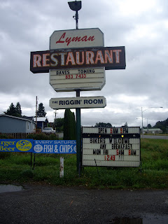
We finally had breakfast around 10:00 AM ... in Lyman, 9 miles before Sedro Wooley. There were several customers there, but there were more flies than customers. I was a bit worried. However, when the food arrived it was good ... plentiful and filling. Just what we needed.
The rest of the ride was pretty uneventful. While we had made pretty good time up until Concrete, we were slowiing down noticeably as the day wore on ... the lack of sleep and the miles were catching up to us. The last stretch was particuarly challenging ... Woodinville - Duvall Road during rush hour ! and then the last hill up to Mark's house ... with grades of 13- 16 %. We made it to the end at 6:30 PM ... 22 hours and 40 minutes. Not a particularly fast ride, but we did it!
While I definitely enjoyed the ride itself (aside from the bridge fiasco), hopefully the ride itself will be enhanced ...we made numerous refinements to the route sheet and a few to the route itself. And you've been forewarned about the dangerous bridge (look at the route sheet for specific location).
Sunday, August 17, 2008
RUSA 243 Sunrise Climb
I was feeling a bit guilty for missing the RUSA 10th Anniversary ride yesterday, but in much better shape after a day of recovery. I really had planned on riding yesterday, but I just didn't recover fast enough from Friday's ride.
I headed out to Black Diamond to start the ride early, leaving the first control about 6:15. It was about 70 and a bit muggy already, but that was much cooler than the past few days have been, so it felt pretty nice. It stayed nice like that almost the whole ride. There were scatterrd clouds along with blue sky, but fortunately the clouds hid the sun almost the whole time. For much of he way between Enumclaw and Greenwater, there was a pretty decent headwind ... with luck it will hold for the way back!
In the picture to the right, where a large stream joins the White River, you can see why they call it the White River ...
I made it to the White River Ranger station by 10:30 and started the long grind up, reaching the top right about noon. While it sure takes a while to get up there, the views along the way and up at the top sure make it worthwhile. The picture to the left shows some lava flows seen on the ride up; the one below shows the view from the 6100 foot viewpoint looking away from Mt.Rainier.
The ride back down was a blast. Not racing down, but simply enjoying the ride. The last few times I've ridden along 410 headed towards Enumclaw there has been a headwind that was just strong enough to shave a few mph off the ride ... not today. While there wasn't a strong headwind, it was either calm or perhaps just a little tailwind. In any case it was great! Temperatures were nice until I hit Enumclaw, which was very hot and very, very muggy. Got back to Black Diamond a bit before 4:00 PM. A very enjoyable ride!
Friday, August 15, 2008
RUSA 341 Leschi - North Bend - Leschi
While I had been on a few short rides (15 miles) over the past three weeks, may lack of riding was getting to me. Even though I would be able to ride the RUSA 10th anniversary ride the next day, I couldn't wait. The stars were lining up and I could get a ride in on Friday. Yes!
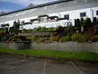
I needed to come up with a new information control question for the Leschi - North Bend - Leschi ride as there had been some changes at the Nestle Regional Training Center - now Camp Korey at Carnation Farms. The old question no longer worked. So the specific ride was decided.
Since it was going to be a hot day, I figured I'd start early to take advantage of the cooler temps in the AM. I rode to the start - five miles or so - and started riding just after 6 AM. Boy,, it sure felt good to be back on the bike again. I was soon on the Burke Gilman, heading north. Around Sand Point a bunch of riders came onto the trail - turns out today is the start of the RSVP ride and they use the Burke Gilman and part of the Samamish River trail ... so I had plenty of company for quite a while. They turned off in Woodinville. I kept going and made pretty good time - it was great riding conditions.
Avondale Road, Novelty Hill, West Samamish Valley Road all zipped by pretty quickly (well, I suppose the hill part of Novelty Hill Road wasn't all that fast). Pretty soon I was at Carnation Farms, or what was the Nestle Training facility, but now is Camp Korey at Carnation Farms. While not a lot of changes from the road, the old info control questions definately no longer worked - so I came up with some new ones ... you'll have to go on the ride to find out what they are!
While the temperatures were warming up, the riding was still pretty comfortable as I climbed up to Snoqualmie Falls and headed towards North Bend ... this is such a pretty ride, especially along here. At North Bend I grabbed a quick bite qnd drink at QFC, then headed back towards Fall City. The lack of riding and the heat were catching up to me as I climbed up from Fall City towards Issaquah ... I definately slowed down. I appreaciated all the trees along the Issaquah - Fall City road ... and bemoaned the lack of them along the climb up Highlands Drive.
The rest of the ride was pretty uneventful ... and hot. The lady at the Shell station in Maple Valley offered me some water as I purchased some gatorade, commenting that she was concerned I was going to pass out due to the heat and she was going to have to give me mouth to mouth. Then she talked about how she would run around on the lava flows in Hawaii with her top off. It was time for me to go ...
Subscribe to:
Posts (Atom)