I visited Heaven today. It was closed.
The road was long, but the time too short.
A canopy of green, a blessing of shade.
The rolling leaf crackles. The ground squirrel scurries. The butterfly flutters.
I stop to soak it in. What is bliss? It must be this.
The sky so blue. The grass so brown. Green? So many shades of green.
Man scars the land. Children replant. Mother Nature heals.
The heat of the blazing sun. The relief of the subtle breeze.
The easy pace of a gentle grade. The anticipation of the steep climb ahead.
An Official Notice - Extreme Fire Danger - Closed to all.
Do I go back? No. Relentless Forward Momentum. RFM. RFM.
The valley continues, as do I.
A fork in the road. The choice is clear. I've been here before.
The quiet road narrows, now a one lane path.
A thin sliver in a deep evergreen sea, an abundance of shade.
The forest reclaims the road, the bushes encroach.
Time to shift, the gentle grade slips away.
Standing now, the heartbeat quickens.
An angry bird cries out - Invader. Begone! Another bird joins in. And another. A chorus.
The forest reclaims the road. A stretch of dirt. Can I find a path? I keep grinding on.
The hill is as relentless as it is steep. RFM. RFM.
A tree snaps. A bird cries out and flies away. The tree is falling! Towards me? I can't speed up!
Steeper? How can it be steeper? There are no more gears.
The tender caress of a leaf - It's okay, you'll make it.
The forest reclaims the road. A boulder marks the spot.
The tinkling of a tiny rivulet. The babbling of a brook. The crescendo of a creek. A symphony of H2O.
Water. I must drink. I have to stop. Relief. Can I rest? No. RFM. RFM.
The wings beat as the large bird flies off. The branch groans with relief as it springs back up.
Will the hill ever end? Can I last? This must be Heaven. Please don't end.
The forest reclaims the road. Little blacktop here. Moss is everywhere.
What is that? The top! Relief. Sadness.
I visited Heaven today. It was closed.
The road was long, but the time too short.
Will I return? I haven't left.
____________________________________________________________________________
As part of riding from Seattle to Crater Lake in August 2013, I rode on Camp Creek Road between Reedsport and Roseburg. A 21 mile stretch of state forest road, followed by a similar 10 mile stretch on Tyee Road was, well, heavenly.
Friday, August 23, 2013


Tuesday, February 8, 2011
PENDING - LK FOREST PARK-INDEX

Route was suggested by Carol Nussbaum
Route sheet is here
Route map and TCX file is here
Route has been submitted to RUSA for approval and is not ready to ride.
DISTANCE: 204K
MAX ELEVATION: 850 feet
CUM ELEVATION: 4,500 feet
Thursday, October 14, 2010
Eastern Washington Loop 400K Pre-ride
Most people would think that starting a ride at 11:30 PM and riding through the night when the temperatures are going to dip close to freezing is simply nuts. They are probably right. But I did it a couple of days ago and would jump at the chance to do it again.
Riding through the night, under clear skies with the stars glowing, is an exhilarating experience. You can't see much but you can see so much. The stars are crisp. The wisps of fog rolling off the wetlands. The dawn beginning to break. Still, it can be a challenge to stay awake. The cold helps.
Lyn Gill and I left East Wenatchee at 11:30 PM. We left town on Rock Island Road. It is the way most of the Seattle Randonneur (SIR) rides leave & enter town, primarily to get off of WA-28 since that tends to be fairly busy. It wasn't at midnight. There was construction on WA-28, so we weaved in and out of the construction barrels a bit, but mostly enjoyed the smooth new pavement. While the ride was going to be relatively flat per Bike Route Toaster ( ~ 6,000 feet of elevation gain over 400K / 250 miles) a noticeable part (we noticed!) of that climbing was in the first 30 miles as we climb up to Quincy. But we were fresh and it was good to get out of the way, right?
By 2:30 AM we were at George, where the first control was. This 24 hour gas station convenience store was going to be a nice place to warm up and stock up for the next 70 mile stretch to the next opportunity for services - not much between George and Lind, especially in the middle of the night. But wait, it isn't open 24 hours. It closed at 10. Oops. Fortunately we really didn't need much. There was a Porta-Potty at the side. So I popped a caffeine pill instead of a Mountain Dew. I lent Lyn my arm warmers - I had planned on putting them on later if I got cold, but Lyn was cold now. Lyn had hoped there would be a fireplace to warm up by ... I gave her a pair of toe warmers as the next best thing. And then we were off.
Over the next couple of hours we saw two cars.
We woke up lots of dogs ... probably a few of their humans too ... at farm houses as we rode along. Fortunately they were either locked up or too tired to come out and chase us. They simply barked at us, either to tell us they were jealous of our freedom or to tell us we were nuts. I only had to yell back at a couple of dogs the whole ride.
One of the busiest stretches of road on the ride was along WA-172 into Warden at about 5:45 AM. Warden isn't a big place. Population is about 2500. While they weren't all up when we rode through there sure were lots of 'em out on the road. Maybe because of the smell - a mixture of rotting onions, potatoes, and manure. No need for smelling salts! I was glad to get past that little stretch.
On to the Lind-Warden Road. Miles of nothing. Gentle rolling hills. Not yet the Palouse. Very pleasant riding as we raced to meet the rising sun in the east. Dawn breaks. While it didn't "warm up" yet, at least it wasn't quite as cold. But Lyn runs out of gas about seven miles out of town. It was a long stretch between George and Lind (~ 70 miles) - so I gave her an Ensure Plus (350 calories) to help get her to Lind. There she could eat her sandwich and maybe get something else.
We arrived at Lind ... not quite half-way (180K of the 400K), but a major milestone and, significantly, the first chance to resupply. It was now 7:45 AM and it was good to get off the bike for a few minutes. Pickings were slim at Jim's Market - the only game in town - but they had Mountain Dew, so I was happy. We chatted with the guy there ... Jim? - he shook his head when we explained what we were doing. He also asked if we were carrying any weapons, which I thought was a bit odd. But I didn't want to know why he asked that, so we headed out.
I had taken off my warm, full-fingered gloves. I knew it would be warming up soon and wanted to be able to access my snacks - beef jerky and rice cakes - which I couldn't do with my big gloves on. It was a problem at first as I lost sensation in my fingers - making it difficult to know if I was grasping any of the finger food, but fortunately it soon warmed up and I was happily stuffing my face.
The stretch from just past Lind to where we turned north on WA-261 was one of my favorites ... I don't think we saw a single car until almost the end of the stretch ... and it was very pretty in a desolate kind of way. And we hit the half-way mark!
At Ritzville we stopped at a Starbucks - caffeine refill! - for some food, drink, and the opportunity to shed a layer. It was almost 11 AM and it was turning into a very nice day. Highs were going to be around 70, so while it was still cool, it wasn't going to be so for long. Better yet, there was actually a little bit of a tailwind for our long ride west.
We headed out, but by the time we got to the other side of town (and Ritzville is not a big place), we decided we were overdressed. It was getting nicer quickly! A quick stop remedied that, and we headed west on what is basically a 40 mile straight stretch of road. Straight if you don't consider all the ups and downs, that is. No really big hills, but lots and lots of gentle rolling ones. It turns out Bike Route Toaster ( a web route mapping site) didn't do a very good job of estimating the climbing ... my Garmin recorded 9,000 feet of climbing - 50 % more than the BRT estimate.
It was harvest time for potatoes. We saw trucks taking loads in from the fields ... and stray potatoes on the side of the road. With the wide open spaces and low traffic, the truck drivers gave us plenty of room. I did get the finger from one SUV driver as we approached Moses Lake ... apparently bent out of shape that he had to move a bit to the left to pass us, even though he didn't have to slow down or wait in any way. Oh well. I waved.
By 3:30 PM we made it to Ephrata ... the last stop before the end. I for one was pooped and glad to sit down for a few minutes. It only takes a few to rejuvenate. Some food ... another Ensure Plus and a Pizza Pocket. I'm sure the Mountain Dew helped too. Refilled the water bottles, while I wasn't on empty, Lyn had run out (Ritzville was a long ways back), and it was now in the upper 60's.
Less than 50 miles to go! And it is a net downhill from here.
Sunset was 6:15 PM. Could we make it past the construction on WA-28 before it got dark by perhaps 7 PM? I hoped so. There were a couple of places around Rock Island that were signed "Shoulder Closed" and that had construction barrels that forced you onto the main part of the road. Fortunately we arrived there while it was still light enough to see that we could safely go through the barrels and ride on the shoulder - preferable to being in the lane of traffic at this time of day. WA-28 was much busier at this time of day. Go figure!
We made it back to the hotel before 7:30 PM ... finishing in 19 hours and 54 minutes. This was Lyn's 2nd 400K ... and she beat her previous 400K time by over 3 hours! Olive Garden was across the street from the hotel ... it was one of the reasons we wanted to get back at a decent hour, as it closed at 10 PM. After showering and changing, dinner sure hit the spot!
Wednesday, July 21, 2010
Seattle to Crater Lake 100K Pre*2 Ride`
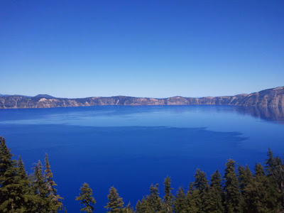
This is an awesome ride. Not an epic bust your gut to get it done ride, but a visual stunner, with lots of pleasant roads and simply fantastic scenery. Don't get me wrong, no 1,000 K ride is easy, especially not with 30,000 feet of climbing, but it isn't a killer. Of course any ride can be with the wrong weather, but we had almost perfect weather.
Vincent & I rode this as a preliminary pre-ride for SIR's fall 1,000K at the end of September. We'll pre-ride it again the week before to identify any last minute road issues and to test out the route changes we're going to make ... not a lot, but there were a few.
The top three things that I'd be sure and do again on the ride were:
1. Start as early as possible each day (we started at 10 PM, 3 AM, & 3 AM). We ended each day in daylight, felt rested, and were in the right places during daylight hours. We also had about 3 hours per day more daylight than there will be during the brevet.
2. Have breakfast in Depoe Bay at Joyce's Sunrise Cafe. It was nice to have a solid breakfast ... and with some 60K out of the way already. They open at 5 AM.
3. Take time for pictures. There are so many wonderful sights on this ride ... and as it is not a killer ride, there is enough time to stop occasionally and snap a picture or two - within reason of course.
The top three things I'd do differently:
1. Avoid US-97 into Klamath Falls (boring, busy, & construction issues) ... we're rerouting to go on the west side of the lake instead.
2. Cut out the last two US-101 by-passes at the south end of Lincoln City ... too confusing (I got off course twice), too many turns, too many steep hills, and too slow. Since we'll be riding through here in the early morning, traffic on US-101 isn't an issue, so we're going to reroute back onto US-101 here.
3. Skip the Crater Lake Rim Village Cafe - take the extra time to eat at the Crater Lake Lodge. There was a 30 minute wait, so we skipped the Lodge and went to the Rim Village Cafe instead. As time really wasn't an issue, this was a mistake. How often do you get here? Enjoy it!
4, Okay, so I can't count ... but I'd carry more water leaving Reedsport on day 2 and Dry Creek on day 3. I had two large water bottles.
So how did the ride go?
DAY 1 - BREMERTON to PACIFIC CITY
Start time: 10:10 PM on Thursday, July 15th
End time: 5:10 PM on Friday, July 16th
Elapsed Time: 19:00
Distance: 401K
Climbing: 9,500 feet
The ride from Bremerton was uneventful ... roads were pretty quiet. Fortunately we didn't have that much of a problem staying awake during the first part. There wasn't anyplace open to stop along the way until the Chevron station in Montesano, but we kept going anyway. Our first stop was Raymond. Unfortunately only the gas stations were open we arrived shortly after 5 AM. The McDonalds didn't open until 6 AM. We were a bit tired, so it was tempting to stick around, but RFM (Relentless Forward Momentum) was the plan.
We found a Cafe open in Nasalle, some 70K later, and stopped for breakfast. It was a needed stop - and yet it was the first opportunity we had ... nothing else was along the way. Not even closed options. From here we made it to the Columbia River and the bridge at Astoria. It wasn't as bad as I had feared ... there was a whole 2 feet worth of shoulder! Still, it was worth making sure the tires were in good shape before starting across - it is a long bridge and I wouldn't want to get a flat on it.
In Astoria we took Business 101 from a big traffic circle in order to connect to a nice back route to Seaside. We stopped in Seaside, as it was a control (changing that, as it isn't really needed), and had some soup. Then off on US-101 again to Cannon Beach. Lots of tourists in Cannon Beach on a sunny July Friday ... who would of guessed that? After a stretch on 101 with some climbing and then wonderful views from Oswald Park down to the South, we went inland for another 101 by-pass - this time on Miami-Foley Road - but first with a stop for ice cream and fluids at the Mohler store.
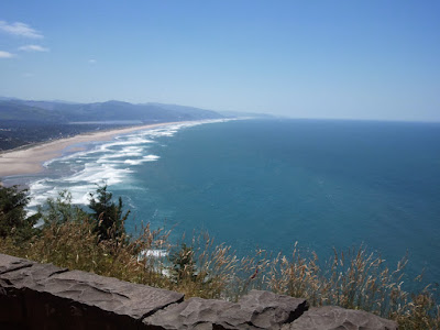
North of Tillamook we got back on US-101, then stopped at Safeway in Tillamook. Got a 6 pack of Ensure Plus so stopping tomorrow isn't as pressing. We arrived in Pacific City early enough that there were several dinner choices - we ate at Fat Freddy's - nothing to write home about, but it was fine. Shake was good. The Shell station/convenience store closes at 10 PM - besides the Pub right next to it (which was packed) everything else is likely closed by then.
DAY 2 - PACIFIC CITY to ROSEBURG
Start time: 3:00 AM on Saturday, July 17th
End time: 8:20 PM on Saturday, July 17th
Elapsed Time: 18:20
Distance: 330K
Climbing: ~10,000 feet
We rolled out of Pacific City right about 3 AM and headed south on 101. Very peaceful at that time of the morning. We found the turn off to Slab Creek, our next 101 by-pass, and started the slow, gentle climb up the quiet road. We actually found a spot with a street light for an information control - since most riders will be going through here in the dark, that will make it easier to both find and then record the answer. After hitting the summit at around 700 feet, we head back down to rejoin 101 briefly before another by-pass around US-101, this time missing the bulk of Lincoln City by going along the east side of Devils Lake. The end of this bypass is the start of another one, this time along the west side of 101 through a residential area - it was very hilly, with lots of turns and climbs. Picturesque enough - in a different way, but I was anxious to make progress, so we're going to cut out this by-pass.

We made it to Depoe Bay shortly after 6 AM and had a nice breakfast at Joyce's Sunset Cafe (right 1/2 block at the traffic light). It hit the spot. The next 140K to Reedsport were a nice blend of quiet by-passes, gorgeous ocean views, lakes, rivers, and Oregon forests. And a few rollers along the way ... and then a few more. Not a lot of places for food & water, but enough as long as you plan ahead. We got separated in this stretch - Vincent stopped & waited for me at the Florence Safeway, but I had kept on going. Fortunately with the aid of technology - cell phones - we reconnected at Reedsport. While we topped off with water here, two bottles wasn't enough for me on the next stretch. Although it was only in the mid-60's in Reedsport, it was in the low 80's inland. Not unbearably hot by any means, but hot enough to drive up my water consumption.
 The stretch between Reedsport and Roseburg was fantastic, especially Camp Creek and Tyee Access Roads. This is 30 miles in the back woods, though the mountains, on a quiet, narrow road. Absolutely no services along the way. We saw only 3-4 cars along the way. It was wonderful. A good place to "buddy up", as you are definitely on your own in this stretch. This also includes the steepest stretch on the whole ride - a 10-12 % climb up to about 2,100 feet. The decent, at the start of Tyee Access Road, is on a rough section of road, so you definitely want to do this during daylight if at all possible ... and watch your speed.
 Out of water, I found a water pump at a roadside county park along the Tyee Road (now noted on the route sheet).
We made it to Roseburg a bit after 8 PM. Dinner was at Denny's - unfortunately they don't serve beer.
DAY 3 - ROSEBURG to KLAMATH FALLS
Start time: 3:05 AM on Sunday, July 18th
End time: 6:45 PM on Sunday, July 18th
Distance: 270K
Climbing: 9,500 feet
The first stretch out of Roseburg was slow, averaging maybe 15-16K. Not due to road conditions - road was fine. No traffic, wide shoulders, relatively flat. Just hard to get started. Advil hadn't kicked in I guess. After 30-45 minutes we got into gear and picked up the pace a bit, perhaps 20-22K. We arrived at Dry Creek - some 75K later, about 7:10 AM. There hadn't been much climbing yet ... we'd gone from about 500 to 1,500 feet. Another 6,100 feet to the top!
From Dry Creek the grade increased ... although not dramatically. While it had taken close to 80K to climb 1,000 feet, the next 1,000 feet took only about 20K ... and then the next 1,000 feet less than half of that distance. The river and forest views were a nice distraction from the climbing ... although I did obsess on what the upcoming grades might be like. They weren't too bad though. It did get warm before Diamond Lake, and running out of water became a concern. There was water at Diamond Lake Resort - about 1/2 mile off the route to the right, but I didn't want any bonus miles and was hoping there would be some along the way (there wasn't). I did make the water last long enough, but having some more would have been nice.
We turned off of OR-138 to head up into the Park. There was a line of cars. Thinking there might have been an accident, I rode off to the side, passing the cars & motorcycles. I then realized this was just the line to get into the park - it costs $5 - and we were cutting the line. Oops. Well, at least we'd made it to 6,000 feet - only another 1,600 to go. The road through the park, while in good condition, did not have shoulders, so required a bit more attention to traffic.
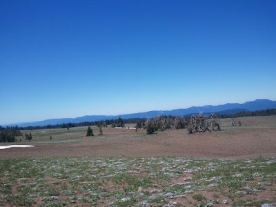
The climb from here was more intense ... but probably because I knew we were nearing the top and I was anxious to get there. The views along the way were worth the periodic stops - I'm sure I was stopping for the view, not to rest :). The only disappointment at the top - the lake was fantastic - was that it wasn't the top ... there was more climbing to go around the lake to get to Crater Lake Lodge. Granted it wasn't a whole lot, but I had been hoping ...
Rim Village and the Lodge area were packed with people. I had wanted to eat at the Lodge, but with a 30 minute wait, we decided to go back to the Rim Village Cafe. In retrospect that was a mistake. For us daylight wasn't an issue and we had lots of time, so a relaxed lunch and more time soaking up the views would have been the better move.
While arriving at Crater Lake felt sort of like "we'd made it" - we still had over 100K to go! Granted there was a lot of downhill, but ... Anyway, the descent from the rim wasn't particularly fast - the roads were fine, but except for a bit at the top, it felt like we could go faster. And the descent was too short ... while we had climbed up over 7,000 feet (500 to 7,600), we only descended 3,600 feet (7,600 to 4,000). The stretch to Fort Klamath was nice - both the descent and then the high plains portion. From here to the end I could have done without - the expansion bumps on the road were annoying and then US-97 was busy and undergoing construction - so a questionable shoulder. We're going to reroute around the other side of the lake instead - a bit longer, but at least it will add a 1,000 feet of climbing! :)
We finished the ride in 68 hours and change - Vincent was 25 minutes ahead of me - I was in no hurry to get done and was enjoying the ride.
POST RIDE - THE TRAIN !
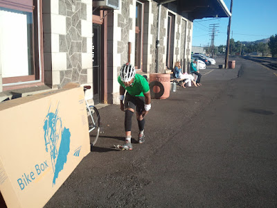
We rode the train back to Seattle (Vincent got off in Tacoma). All in all it was a restful experience - I hadn't done it before and would definitely do it again. There is one train a day from Klamath Falls to Seattle - it left at 8:25 AM and arrived in Seattle at 8:45 PM ... a little over 12 hours. The station opens at 7:30 AM - you need to get there early in order to get a bike box, partially disassemble it (remove pedals, turn handlebars), put your bike in the box, label it, and then turn it in (cost $15 for the box + $5 shipping). They keep about 15 boxes on hand - we'll give them a count when registration closes 2 weeks prior to the ride so they can have a few more boxes if need be. The ticket to Seattle cost just under $80.
Seats are roomy & comfortable. There is food on the train - a snack bar (the basics ... including beer) and then a dining car (I didn't try that out). It is worth bringing some of your own snacks & beverages if you have the time and arm space to do so.
The seats are assigned by a conductor outside the train cars - so if you want a window seat, ask for it. I lucked out and got a window seat - but there is an observation car that you can go to if you didn't get a window and want to stare out.
Most of the cars have electric outlets if you want to charge your phone or mp3 player - if you brought it and a cord that is.
All in all a wonderful ride ... both to and from Klamath Falls!
Here's the link to the complete set of pictures ...
 |
| Seattle to Crater Lake |
Sunday, June 6, 2010
SIR Spring 600K - 4 Mountain Passes
3:40 AM. even before the alarms go off, I'm up and dressed, ready to go. It's a short drive to Issaquah and the 5:00 AM start of the 600K. I'm there in plenty of time, which is great, as it gives me lots of time to chat. People are surprised I'm riding ... didn't you do the pre-ride is a question I got several times. Vincent & I plan to ride together, which is nice as we haven't done that much recently. He says he'll be my shadow ... which presumably means he won't race off into the sunset (at least too often).
Then it's time - we're off. The first 30 miles .. out to Monroe ... go quickly as I'm riding in a group of a dozen or so riders and we socialize along the quiet roads. I chat with Mark Roehrig about the Cascade 1200 route - it is looking like we'll be using the 2008 route, as there is too much snow on the Carson route. It is nice to hear that Joe Platzner will join us on some of the mid-week rides this summer and that he's thinking about the September Crater Lake 1000K, which should be a great ride.
Vincent & I drop back as the rest take off on Ben Howard Road. We tend to start a bit slower, then build our pace. By Skykomish - mile 65 - the first control, we've caught back up and even passed many of them. We zip in and out of the control and we're soon gaining elevation ... we turn onto the Old Cascade Highway for the first secret control of the day ... Bob Brudvick and Mark Thomas are there telling jokes and signing cards. Vincent tells Bob & Mark he's planning on convincing me to ride through the night - what? I ignore it. Anyway, we're off.
All too soon the real climbing starts... it is a slow but steady grind up to the top of Stevens Pass at 4,000 feet. We catch up with Joe Llona on the way up - chat for a bit about the Spring 400K that he hosted while we climb, then go on by. My shadow soon disappears up and over the crest ... not to be seen again until several miles on the other side when he stops to take a phone call ... he's on call this weekend.
The weather is great .... sunny and warm as we pull into Leavenworth. Vincent is distracted by an almost topless woman in a big SUV at a stop sign - hits a pothole hard, but fortunately no damage done. We pull into the control ...the Subway ...and Charlie White, Mark Roehrig, and a couple of others are there slathering on the sunscreen. First time this year I've needed to do that! They soon head out, while we restock and take a few minutes to eat a snack.
On to climb # 2 ... Blewitt pass. It starts out very gradual and doesn't actually ever get all that steep .. but just keeps climbing. Twenty one miles from the turn at 1,100 feet to the summit at 4,100 feet. Amy Pieper is riding her bike down, turns and, rides a ways up with us - she and Robin are running the control at the summit. She is planning on riding over Old Blewitt. She says good-bye as she stops to fill up her water bottle, but a few minutes later zips past us. Vincent can't let that happen, so he picks up the pace - we catch up and ride with her. Fortunately for me she turns off to go up Old Blewitt in a mile or two - although she turns onto King - maybe it connects to Old Blewitt somewhere? We press on. I manage to keep Vincent in sight the whole way up ... he's only a couple hundred yards ahead of me. We make it to the top, where Robin is signing cards and dispensing goodies. A cold coke hits the spot.
We don't stay long ... leave before some of the riders who were there when we arrived. It is a nice descent for the next 14 miles, then 500 feet of climbing as we head up a ridge towards Ellensburg. Dinner! We stop for some real food ... or at least quasi real food. We stop in KFC for Chicken, mashed potatoes, baked beans, and a biscuit. A nice refresh. I take a couple of legs and biscuits to eat on the road. Something to augment the Ensure Plus I have every 50K. It is almost 6:00 PM now. With luck we'll make it to the "secret" control at US-12 before dark and to the overnight by midnight.
I start thinking about riding through the night. While today's weather has been great - sunny & mild - not too hot, the forecast is for that to change during the night ... rain starting. Riding through if it is still nice might let us get some of the climbing/descents out of the way before the rain hits. But sleep would be nice too! And 5-6 hours worth - wow that would be cool.
Yakima River Canyon is very pleasant - and a practically flat alternative to the climbs that I-84 takes between Ellensberg & Naches. Only 1,200 feet of climbing compared to 2,400 feet. Not much traffic - we enjoy the quiet as the shadows lengthen. Two years ago, riding this stretch with Dave Harper we had to put on our night gear at the end of the canyon ... I figure I'm an hour or so ahead of that pace. I'm grateful for that as we ride along US-12 between Selah and Naches. This stretch is almost criminal. Foot long rumble strips right smack in the middle of a shoulder that usually ranges between 18 inches and 3-4 feet. It does not meet DOT standards! I hug the left few inches of the shoulder and am grateful it is still daylight so I can see any road debris in advance. Fortunately it is a relatively short stretch - about five miles.
The skies are still clear overhead, but looking ahead towards the mountains clouds are creeping in to the picture. We should make it to the overnight without much impact ... but the forecast for rain tonight seems probable.
Brad Tilden & crew are at the secret control at US-12 & WA-410 ... with chairs, sandwiches, & cokes. They've got quite the setup - generator, lights, stove. We sit & eat for a few minutes - recharge the legs - then rig for night riding and hit the road. Only 1,600 feet of climbing till the overnight, saving the last 1,500 feet to the summit for when we restart. It is a very gradual climb - painless if we hadn't already ridden 270 miles !
As we near Rimrock Lake, my light startles a big deer at the side of the road ... it dashes away - and I get a rush of adrenaline ... it had startled me too! That speeds me up and we soon arrive at the overnight - about 11:30 PM.
Jeff Tilden and Peg Winczewski welcome us - feed us bowls of hot chicken & rice soup. Yumm! We decide we'll stay an hour or so - eat, clean up (get rid of the salt crusted on my face), change, reload the bikes - and then head off. Fully expecting rain, I put on rain pants & winter riding gloves - I don't like being cold & wet! Two years ago the White Pass descent was frigid - sometimes I learn from my mistakes :) Kole, who had arrived at 10:00 PM gets up to join us. Before we leave Charlie White arrives ... looking very glad to be here. All too soon it is time to depart.
I have to remind myself - why am I riding on? Oh yes, Vincent is on call and needs to get to Enumclaw so he's within cell range in case he's called. But now that Kole is going to ride perhaps I can sleep? No, I put the thought out of my mind and start the climb. And it turns into a real climb now. Not super steep by any means, but while the 1600 feet of climbing from the base to the overnight had been over 25 miles, the remaining 1500 feet were done in only 8 miles. Three times steeper! Kole & Vincent being much faster & stronger riders, they soon are way ahead of me - with only their flashing red lights proof to me that they are still there. Kole eventually takes pity on me and waits for me to climb the last bit to the top. A few raindrops hit. A hint of things to come ... but they don't last.
We quickly descend to the next control at US-12 & WA-410. Ian & Corey are asleep in the van ... we wake them up to sign our cards. I suppose we could have just answered the info control question instead - but we thought they were just in the van staying warm. Oh well.
Three mountain passes down ... Cayuse Pass, the last one, and the highest at 4,675 feet, is left. It is a slow sixteen miles to the top. With maybe five miles to go I have to stop and rest ... even just a few seconds of not cranking away feels so good. It is getting colder now ... old snow at the side of the road...and the occasional raindrop is making an appearance. As tired as I am, I am still enjoying the sights & sounds as it begins to get light - the birds waking up and the many different sounds of water making its way down through the woods & off the rocks at the side of the road. In places it is so loud I'm fearful as I go past.
But I finally make it to the top ... Kole and Vincent are waiting for me ... Vincent taking a ditch nap in the road as it starts to rain. We get bundled up for the ride down. The road is wet now, and with the solid rain it is getting wetter. As it is not yet daylight - perhaps pre-dawn light - I ride down at a "cautious fast" rate, slower than Kole & Vincent. I catch up to them at the turn to Crystal Mountain. They've stopped to put on more rain gear - I put on my rain shell.
Food is on our mind as we ride down towards the control at Greenwater. We suspect we'll be there before anything opens though. Still, we can hope. We work on a backup plan - there is a cafe at the turn off WA-410 in Enumclaw. Maybe that will be open. If not, there is a Safeway in Enumclaw that we could go to ... just a few extra miles.
Greenwater ... just a handful of houses, a general store, a tavern, and a couple of shops ... is all closed as we go through at 6:15 AM. Enumclaw here we come! Only 17 more miles till food. The last couple of miles are especially painful ... the water running down my face is full of salt, which gets in one of my eyes and burns. I ride with one eye shut for part of the last stretch. But hurrah! The Cafe is open as we arrive at about 7:15 AM.
We turn the waiting area into a laundry room, with wet coats, hats, & gloves draped over chairs. We order hot drinks - Hot chocolate, tea, coffee. Warmth! Then order real food. It tastes great. And it is nice to sit ... not on the bike.
As we leave at about 8:00 AM, I tell Kole & Vincent to go ahead and not wait for me on the home stretch ... I'll try and stick with them for a while, but there is nothing left in these legs but pain. While I enjoy riding with them, they tend to ride faster than my normal pace. It definitely wears me down.
Three hundred twenty five miles down, only fifty miles to go. No major climbs to deal with ... just some rollers and then the "victory lap". With 20 miles to go, we pass within two short miles of the end ... but have to ride the twenty miles around Lake Sammamish. It is cruel. I half expect someone to be there taunting us as we go by.
Kole and Vincent have gone ahead now ... they are planning on eating some ice cream at the last control. In a few miles I get a flat. And I can't find the cause. As I go to pump up the replacement tube - the pump fails. Oh no. I'm not going to DNF this close to the end am I? I work with the pump and it is full of water. Fortunately I manage to clear it out and get it working again. But since I couldn't find the cause, am I going to get another flat right away? Fortunately not. Perhaps it is the time off the bike, but I feel refreshed and make good time the rest of the way.
At 12:35 PM I arrive at the end. Vincent & Kole are there ... they've been there for about half an hour. It is darn nice to be done! Brad's wife (sorry, my brain is mush) is serving up pasta, but my focus is on getting home and going to bed. Before I leave, Don Smith arrives with a report that it was raining at the overnight as the riders left in the early morning hours - they had cold & wet climbs & descents. Looks like we made the right decision to ride through the night!
Thursday, April 1, 2010
Road Trip: Baker Lake 400K - The right Rx
Sometimes we get in a rut. After close to 30 rides this year - 100's, 200's, and even a couple of 300's, they were beginning to be a bit repetitive. Enjoyable, yet predictable. It was time to shake it up a bit. On Sunday, as we were riding near Granite Falls, the topic of what to ride on Wednesday came up. I suggested a couple of the 200K Permanents that were nearby, and then ... how about a 400K ... The Baker Lake 400? Vinnie lit up. Kole was in. It was a go! Midnight Tuesday evening/ Wednesday morning was set as our start.
A check of the weather forecast - showers and chilly, but not downright cold and rainy - was confirmation that we were on. Moved the start time to 2:00 AM though - that way we'd get to Marblemount late enough that it would be above freezing (a forecast low of 31, but high close to 50).
A posting to the SIR list brought Dan Jensen into our cast of characters.
Starting time was soon upon us and we met at the Redmond QFC shortly before 2 AM. Scattered high clouds and an almost full moon ... looking good! Vinney is psyched - laughing before we even start riding. We head out and oops ... within a few miles, Kole gets a flat. He claims he never gets a flat, but that's two on the last two rides ...
The ride from Redmond to Arlington goes by quickly and, until we get near Arlington, is dry. Unfortunately the Arlington Haggen is no longer open 24 hours, so shortly after 5 AM we pull into the McDonalds/Chevron. The clerk claims to be "living the dream" when I ask how he's doing ... afraid of the answer I don't ask for clarification. The dude that was hanging out with him beating drumsticks on an eraser is enthralled with our bikes and barrages us with questions/commentary. Somehow the stop seems a bit long !
Darrington is not a scheduled stop, but we stop anyway. I think Kole impressed the locals, eating an ice cream bar in front of the store ... it is just above freezing at 7:30 AM. A young guy is hanging out at the tables inside the store. He asks where we are going ... I tell him Baker Lake. He has his mountain bike out front and wants to know - can he join us? What am I going to say? Sure. He offers me a beer from his 18-pack. When I decline, he decides against joining us. Oh darn!
We are soon on our way, enjoying the brisk morning. Fresh snow on the hillsides, perhaps a 1,000 feet or so above us, is gorgeous. Occasional low clouds, almost fog like, gives some stretches a misty feel along the Skagit.
We had planned to have a sit-down breakfast at Clark's Cabins (the control) outside Marblemount, but it turns out they are closed on Tuesday's and Wednesdays. Oops. Not wanting the 5 bonus miles that would result from going all the way into Marblemount, we opt for the info control backup and decide to stop at the Rockport Country Store to see if there are any options - with snacky stuff as a backup.
The clerk and a customer gives us some options in Concrete, where we are turning to head up to Baker Lake. We know about the choices a couple miles past the turn, but since we want to avoid bonus miles we are glad to hear there are some options ahead of us ... only 8 miles away! Eating a full meal and then heading up Burbee Hill (a mile plus of 10-15 % grade) isn't ideal, but we are hungry.
The State Park at Rockport has a sign .. closed Wednesday and Thursday. We aren't going to stop there, but is there a pattern forming?
When we get to Concrete, we ride through the main part of town - off the main highway - and find the restaurant. It is dark ... the open sign in the window is off. Dang it. We ride on, but before leaving town Vincent asks some folks at the side of the road. They say, no, no the restaurant is open. We go back and, sure enough, the front door is open and we go in. It is dark and quiet, and before we can sit down, a man comes out and says they're closed today. Oh well, at least we won't be climbing on a full stomach !
We start climbing and Kole/Vincent soon disappear around the bend. It is a slow grind, but Dan and I eventually make it to the top of the steep part. It is as steep as I remember, with grades of 10-15 %, but fortunately the chip seal is not as bumpy as it was before. And no loose gravel like in 2008.
It is a long stretch of quiet riding up to Baker Lake and the Baker Lake Resort. Dan and I arrive at the turn into the resort at noon - the fenced gate is shut & locked, with a violators will be towed sign ... and no Kole/Vincent. I look for tracks to see if perhaps they went in anyway, but with the gravel and vegetation, I couldn't see any. As Kole hadn't been there before ... and there being no sign announcing that this is were Baker Lake Resort was ... and Vincent not being known for catching all the route turns the first time, it appears likely that they simply missed the turn - which was not at all obvious - and kept going. We decide to go a little further to see if there was any sign of them, but quickly come to a "Pavement Ends" sign. Since there was no other way out, we figure we'll sit and wait back at the turn. They have to show up eventually, right? After 15-20 minutes we give up, work our way through the fence, and start in ... and of course Kole/Vincent then show up - they had gone in and had been waiting for us inside. Oh well.
We make it to Sedro Wooley about 3:00 PM ... and have some real food at the Subway. It is good. By about 3:30 we hit the road. Dan has a flat tire that delays us a bit. Granite Falls is the next control, which we reach about 6:45. Not quite as low a convenience store food, we stop at McDonalds for some more "real food" (term used loosely). A customer, seeing us in our bike clothes, asks if we "Motocross". When I say I don't he mumbles something about us not knowing what real biking was. Sensing that conversation isn't going to go anywhere worthwhile, we part.
Only 40 miles to go! And the weather is still holding. But as it will soon be dark and cooling down ... and there is a menacing cloud in the direction we are heading, I put my raincoat and reflective sash on, and turn the taillights on. As it is still warm enough, I pass on the balaclava and heavy gloves - opting to keep my fingerless ones on instead. I am soon to regret those choices.
As we head south from Granite Falls, dusk begins to settle in, but it is still quite pleasant ... other than the question of why are we riding towards that big dark cloud that is clearly going to mean rain? The setting sun and cloud reflections give the mountain off to the east a pretty orange glow ... and the clouds ahead of us have an odd orange blush to them. The sky above ... and to the southwest of us ... is clear. Would we be able to skirt the rain that is almost certainly ahead of us? Perhaps a re-route to avoid a thunderstorm is in order ... would that fly from a RUSA rules perspective? Safety and all that? Aah ... we'll be fine.
Turning onto Lk Roessinger Rd we start to get the occasional raindrop ... but we are heading a little east now, so maybe we'll be far enough east to miss the full rainstorm. Nope. As we near the south end of the Lake it starts pouring ... then buckets of wet snow ... think vanilla slurpee ... and within 100 yards the road is covered with almost an inch of slush. Where is the road anyway? My glasses fog up and with ice water running into my eyes I can barely see. My eyes are stinging, my hands and head are freezing. Do I stop to put my gloves and hat on? Is there shelter somewhere to wait this out? Is it safe enough to go on? We're on a bit of a hill, headed downhill, turning onto Woods Creek Rd. Forward. We know this is an isolated cloud ... we'll get past it. Somehow. Vincent is ahead of me, Dan and Kole behind me ... at least to start with. I'm trying to go slow enough to not slip, fast enough to get out of this quickly, while barely seeing ... and freezing. After a mile or two we are through ... dry pavement and practically clear skies again. Wow!
I catch up with Vincent ... no sign of Dan and Kole, but we figure we'll get to the control and wait for them in the warmth. It is a great ride - fast and downhill towards Monroe. Before we get there though, it starts to hail, then pour. Being closer to town now, there is oncoming traffic. With the water in my eyes and on my glasses, I have a hard time seeing anything due to the glare from the headlights. I can usually see Vincent's flashing taillight, so I aim for that and hope for the best. A few minutes later, shortly before 9:00 PM, we pull into the Monroe 7-11. I quickly dry off my face, glasses, and warm up. I also get out my warm gloves & hat for the remaining 20 miles! Kole & Vincent soon make it in ... and then the rain stops again.
Mostly clear skies and only a few raindrops the rest of the way. Kole and Vincent make a dash to the end, arriving at 10:30, while Dan and I slog it out, grinding slowly up Woodinville-Duvall Rd and finishing about 10:45. We celebrate a great ride with a round at the Irish Pub ... Thanks Vincent!
A bit of rando adventure - the right Rx to bring out the smiles! But Vincent's now talking of a 400K per month?
Saturday, February 20, 2010
It always rains in Seattle

so I must be somewhere else. That's Mt. Baker of in the distance over the Puget Sound ..taken from Fort Flagler on Marrowstone Island.
It is the 20th of February ... normally a grey, rainy, chilly time of year in Seattle. But it was sunny, warm (mid-50's), and absolutely gorgeous. Granted we were out riding one of the most picturesque permanents - #342 Bainbridge - Port Townsend - Bainbridge, but OMG. We could not have asked for or imagined a day as nice in February ... there were guys walking down the street in Port Townsend with their shirts off! Well, I guess we could have asked for the gals to be walking down the street with their shirts off! :)
 We had lunch in Port Townsend at the Lighthouse Cafe ... well it was breakfast at lunchtime. An Italian Scramble hit the spot. The view was great.
Mark, Bob, Bill, & I made it back in time to catch the 5:30 ferry - Vincent & Kole presumably made the ferry before us (Vincent was "taking it easy today"?). Hopefully everyone else (Peter M, Mike R, Joe L, Art L, Lyn G. & Tom B.) made the next one.
 Lyn had a couple flats in the early stages of the ride and was helped out by Tom Brett. When we ran into them on Marrowstone Island (they were headed to the control, we were coming from the control), it was pretty humorous to watch all the guys go to the aid of the "damsel in distress" (Lyn had no spare tubes by this point).
Sunday, November 1, 2009
When is 251 < 206 ?
Most mathematicians will tell you that 251 is MORE than 206. Normally they are correct. This weekend they would have been wrong.
Sunday's 251K Permanent (#188 Whidbey Mambo) took LESS time than Saturday's 206K Permanent (#52 Redmond-Carbon Glacier). 11 hours 14 minutes vs. 11 hours 40 minutes. It took less time to go an extra 45K.
A bit odd I guess, but not really when you look at why. No flats today ... I had two flats yesterday. We struggled with a headwind yesterday ... we enjoyed a tailwind today. We had a sit down meal yesterday ...we missed out on one today because we were too darn fast ... arrived at the Mambo Italiano Cafe in Bellingham 45 minutes BEFORE it opened ... so we decided to bag it and had a convenience store "snack meal". Vincent's light malfunctioned today so we pressed it to get back before it got dark ... riding the last hilly 25 miles at around 17 mph. A wet, rainy day yesterday ... a gorgeous, sunny day today.
Two very different rides ... but both very enjoyable!
Sunday, October 25, 2009
Road Closed Ahead ... They don't mean us - do they?
Vincent Muoneke, Kole Kantner, Steve Davis, & I rode the inaugural (as a Permanent) ride of the Olympia - Vader - Olympia Permanent (#545). I had hoped we'd get some of the Olympia area randos to join us, but the late notice and distance (a 300K) kept that from happening. It was a ride of surprises ... pleasant and otherwise.
The first surprise was that the weatherman was right ... it was a pretty nice day. No rain and there were even stretches of blue sky and sun. It was chilly at the start ... it got down to 37 and at the end, but Kole and Steve weren't too cold in their shorts the rest of the time.
 No surprise was the gorgeous ride through the Capital Forest on D-Line road. A relatively short albeit somewhat painful climb up to 900 feet, then a long gentle descent along a picturesque creek. This is one of my favorite sections in the state. Today did not disappoint!
A brief ... well, not so brief ... stop at Porter Creek, and then hours of meanderings through the backwoods of southwestern Washington. Relatively flat, with periodic hills thrown in to keep us honest. An unscheduled stop in Adna to refuel, then a long stop in Vader for real food.
 Vincent had two breakfasts; the rest of us had Mountain Mash .... it was real good, but then we were real hungry and almost anything would have tasted good.
On leaving we noticed my rear tire was low ... I decided to just pump it up and see if it would hold (I'd topped it off the night before) ...to my surprise it held just fine the rest of the way (I need to change it today ... it's almost flat now). We pumped it up just past a "Road Closed Ahead" sign. We had detoured around this closure (without seeing it) last month on our ride up to Johnston Ridge, but I knew that it had been passable, as James Gutholm had gone through it a few days later. So we figured we'd be able to work our way through.
 Wrong. At least not easily. However, rather than a 6-7 mile detour, we passed our bikes from one ledge to another (top part of picture ar right) to get them down into the gap, then carried our bikes up the ladder on the other side (bottom part of picture at right). As soon as we were done, the ladder was pulled ... if we had been five minutes later there would not have been a way to get through here.
 There was so much mud/sand/grit in our cleats and on the bikes that the clips were useless. Fortunately there was a hose at Winlock where we washed off. I don't think we saved any time compared to the detour.
It was just getting dark as we arrived in Chehalis for the last real control (two more info controls), so we finished prepping for night riding. Then set out again.
 We had to adjust the information control question at the next stop ... couldn't find a sign for the gun club in the dark ... and then another road closure sign. Three miles ahed the road was closed. Was a bridge out ... a slide take away the road? No clue, but we went for it anyway. It would mean a 15 mile detour instead of a twelve mile detour if we couldn't get through, but why not? We were able to get through ... it was just a repaving project ... but they had sealed off the ends pretty well. We managed to find our way through / around the barricades and were off and running again.
 At Bucoda we had a pleasant surprise as we ran into Ian Shopland. He had been biking back roads with John Pearch. We rode with him a little ways, then parted as our route back was much less direct than his.
The last major stretch of the ride was on the Chehalis - Western Trail. Normally a nice ride, I have no plans to ride it again this time of year. In many places it was covered in several inches of big leaves ... unsettling to ride through, especially in the dark. Where is the trail anyway? And is that a log under those leaves?
We finally made it back at 11:02 - just over 16 hours ... With almost three hours off the bike, it wasn't our most efficient ride :) 8,100 feet of climbing (per Training Center; 8,377 feet per Garmin Connect.
Monday, October 12, 2009
TOUGHEST WASHINGTON STATE CLIMBS
Okay, just one man's view here, and I recognize that I haven't ridden all the possible climbs in the state - particularly those in northeastern Washington ... and nothing off-road, but anyway here's a quick look at a bunch of the major paved road climbs in the state. This is a simple view ... ranks the climbs based on their elevation gain and on the average grade of the climb - a 50-50 weighting.
So the toughest five climbs ... without taking weather into account or the maximum grade or whatever ... are:
1. Hurricane Ridge 5,200 feet / 5.3 % grade
2. Washington Pass from Newhalem 6,500 feet / 3.9 % grade
3. Johnston Ridge Observatory from Toutle 5,600 feet / 3.4 % grade
4. Mt Baker from Glacier 4,500 feet / 3.6 % grade
5. Loup Loup Pass from Malott 3,400 feet / 3.8 % grade
Here's the link to the spreadsheet with the data.
There is measurement system error in this - I used Bike Route Toaster for the elevation info and I adjusted the grade calculation for a couple of the rides that had significant descents embedded in the climb to reflect the climbing over an estimate of the distance net of the distance spent descending.
HURRICANE RIDGE

Vincent and Charlie catch a breather in Port Gamble on the way back from Hurricane Ridge.
Lynn Gill, Kole Kantner, Charlie White, Vincent Muoneke, and I set out on the 6:10 AM ferry from Seattle to Bainbridge to climb up to Hurricane Ridge (5,200 feet) ... and return 286K / 170 miles. It was cold ... just above freezing when we set out and when we got to Hurricane Ridge. It was a nice day anyway ... and we were only a little concerned about the possibility of running into ice (we didn't).
We said hi to Dan Jensen at the ferry dock before we left ... he and Alan Bell were riding the Hood Canal Loop 2.0 from Bremerton. They beat us to Bainbridge at the end ... the ferry worker had heard we were coming from Dan/Alan.
As we were about to get off the ferry at Bainbidge, a bakery truck driver gave us a loaf of fresh bread for our ride. A nice treat that we enjoyed at several stops along the way.
With almost 13,000 feet of climbing, this was a tiring ride. The 5,000 feet from Port Angeles to Hurricane Ridge is a long, grueling climb ... but fortunately very manageable. Basically a consistent 5-8 %, with nothing over 10%. The rollers on WA-104 and US-101 added another 8,000 feet.
 After a brief rest at the visitor center, we bundled up for the ride down.
Lynn struggled with her lights, but managed to make it without running into anything too big.
The biggest challenge we had was Vincent broke a spoke with about 17 miles to go ... huddled at the side of WA-104 in the cold and dark on the narrow shoulder, mostly staying out of the ditch and blackberries, Kole and Charlie performed surgery, removing Vince's rear brake so he could pedal. A couple of miles down the road, at the Port Gamble Road turn there was room to spread out a bit ... and a street light. We tried putting on a fiber spoke replacement, but couldn't remove the broken spoke ... a non-standard set-up. So the decision was made to ride gingerly the rest of the way, crossing our fingers that it would hold. It did!
We had time before the 10:30 ferry, so we stopped at a convenience store and Vince & I each bought a can of Fosters for the ferry ride back. Sort of becoming a tradition, as we've done that several times now. Very refreshing!
Thursday, September 24, 2009
Mt St Helens Permanent - It was a blast !

Seven of us (Left to right - Steve Davis, Vincent Muoneke, Jeff Loomis, Lynn Gil, Mark Thomas, and Dan Jensen) headed out for a ride on the first full day of fall. The forecast was for a great day and we weren't disappointed. The ride started in Winlock, so even though we left home early, we didn't start riding until 8:00AM. It was cold to start ... frostbite anyone? I'm glad we didn't start riding earlier. But it soon warmed up.
I'm not going to name names, but someone got lost before we left Winlock ... we hadn't gone even a quarter of a mile and we had all left together! Granted he was following the route sheet and the Garmin course, but Vincent somehow missed the e-mail describing the detour and then must have been looking down when we turned. Fortunately we backtracked & found him before many bonus miles were generated.
 Mark had discovered before the ride that the Winlock-Vader Road was closed. Not only did this mean we were able to come up with a detour up front, it meant we got to skip a potential coffee stop in Vader. We made up for it by catching the Castle Rock Bakery for coffee & pastries. Bucking the trend, I went for the soup option.
 On our way up, we were crossing a bridge when we noticed a backpack and rope on the side of the road. Curious, we stopped and peered over the edge. It was a loong way down, but the strange part was there were two guys climbing up! And we thought we were odd! Hopefully noone tossed their stuff in their car and drove off with it.
Not for me thank you!


We made it to the top around 3:00 PM ... and were tired & hungry.
But the view was worth it!

We eventually recovered enough to get back on our bikes for a great descent back ... interrupted by a 1,300 foot climb up from Coldwater Lake. We made it back shortly before 8:00 PM. There had been 9,000 feet of climbing ... more than I had expected.

Friday, September 4, 2009
2009 Cascade 1200
We just finished the Cascade 1200. Sort of. The regular Cascade 1200 Brevet wasn't offered in 2009, but the 2005 Cascade 1200 course is available as a Permanent, so Vincent Muoneke, Kole Kantner, Ralph Nussbaum, and myself decided we'd give it a go. The regular Cascade 1200 Brevet run by the Seattle International Randonneurs (SIR) is known for its support and the potential for extreme heat in eastern Washington makes an unsupported ride - unwise to say the least. We were fortunate enough to arrange for support from two of the "significant others" - Carol Nussbaum and Trudy Frantz. I can't imagine finishing the ride without their support.
Day 1
The first day was going to be a long one, so we decided to head out at 5:00 AM, same as the regular C1200, and so stayed overnight in Monroe to get as much sleep beforehand as possible. It was a good decision.
The first stretch, from Monroe to Issaquah, passed quickly. Then a turn for the worse. Rain. We hadn't expected that. The forecast had been pretty good, although chance of showers had creeped in. These weren't showers. We had pretty solid rain for the next three hours. At least we had rain gear and it wasn't cold, so we did okay. It was nice when it lifted and we were able to dry out. We had lunch at the Eatonville Subway. From there we rode to Morton, then Randle before starting one of my favorite parts of the ride, down between Mt Adams and Mt St Helens. A bit of climbing, then dinner at a secret control at Iron Creek Campground. Then our first major climbs ... up and over Elk Pass to Northwood. We set a pattern here that we would repeat over many of the climbs ... Ralph was the last one up, but the first one down. A Kamikazi on the way down! We had some great views of Mt St Helens as the sun was setting. It was dark by the time we reached the Northwoods control and the store was closed, but Carol was there so we were able to get supplies from her. Then the last climb of the day over Old Man Pass. We arrived at the Carson Hot Springs Inn about 12:40 AM ... Carol had hot soup for us, which hit the spot. It had been a long day, with over 12,000 feet of climbing and 224 miles of distance.
Day 2
A few hours of sleep and we were up at 4:30, hitting the road at 5:30. It was a compromise start ... some of us wanted to start earlier, getting more of the ride done while it was cool, while others treasured sleep more. Today was another long day, although a little less distance and climbing - 10,000 feet and 212 miles. However, now that we were in eastern Washington heat would be a factor. We were fortunate that it would only get to the low 90's, but that was hot enough. It slowed us down ... at least Vincent & I. Ralph claimed the heat didn't bother him and Kole, well he's simply amazing ... makes everything look easy. Kole hit 700,000 feet of climbing for the year, well on his way towards a goal of 1,000,000 feet.
 This was a painfully slow day. It took us almost six and a half hours to go from Carson to Goldendale, only 62 miles. We stopped for breakfast, stopped for the bathroom, and just rode relatively slowly. Sometimes it is like that. At least it was a pretty section, first along the Columbia River and then mostly up the Klickitat River valley. Ralph had said he wanted to stop at Klickitat, so when we got there Vincent & I stopped and went into the store ... but Ralph and Kole zipped on by. Oh well, we figured we'd catch them on the climb out of the valley that was a few miles ahead ... and we did. Unfortunately Vincent left his wallet in the park by the store ... or at least that is what we guessed happened later on.
 When we arrived at Goldendale (a control), we met Carol for lunch and to stock up on water for the long barren stretch to Sunnyside ... 71 miles with heat and more climbing. Vincent and I also took the opportunity to charge our Garmins. From Goldendale we gradually gain 600 feet, then rapidly lose 1,000 before a painful climb of 600, then back to a gradual climb up to 3,200 feet (another 1,600 feet or so) near Bickleton. Having cleared the concept with Edward Robinson at RUSA prior to the ride, we had a couple of water/ice stops on the way to Bickleton ... which was a very good thing as I was running out of water.

We made it to Sunnyside about 7:30 and ate at a Subway. Only 85 miles to go! We rigged for night riding and headed out and up ... a 1,000 foot gentle climb. We eventually make it up and over, then on the way to Mattawa we turn left in front of the Hanford gate. Vincent misses the turn and heads for the security gate. With visions of flashing sirens, warning shots, and overzealous security guards we yell at him to turn ... fortunately he realizes his error and turns. Without any id (due to losing his wallet), it could have been a difficult discussion.
We arrive at Mattawa, having made plans for nice cool ice cream sandwiches ... but the 24 hour Shell Station is no longer 24 hour ... everything in town is closed as it is now after midnight. Kole finds an outside faucet and he & Vincent refill their water bottles. No sense dilly-dallying, we've still got forty miles to go!
As we ride along the Columbia, I look back and across the river. It is a clear sky, with an almost full moon, with a clear reflection shimmering on the river. Gorgeous.
Then our last climb of the day up Beverly Burke Road. At the top Vincent & I wait ... Vinent sees a red light high in the sky, moving erratically. I tell him he's nuts, then see it myself. Don't know what it could have been. We finally make it in to Quincy around 4:40 ... 23 hours after we started. Ouch.
Day 3
We had originally planned to leave Quincy at 7:00 AM and had been having discussions that it would be good to leave earlier ... but that was before we arrived at 4:40 AM. So we got our hour of sleep and left at 7:00 as originally planned. Didn't have much of a breakfast in Quincy, as we planned on a full breakfast in Ephrata. We stuffed ourselves there ... I had a "Cowpoke" at the same Cafe we'd eaten at after the spring 400K pre-ride. It was good except for the climb up out of town. The Spring 400K ride through Moses Coulee (but not the pre-ride) had been marred by a 4 mile stretch of torn up road. That was back in April or May and shouldn't be an issue now, Sep 1st right? Wrong. As we start on the now gravel section we pull up to the flagger and his stop sign. Ralph comments on the need for sunscreen ... the flagger says something to the effect that there's no need for sunscreen, he's a smoker, so that'll kill him first...I guess that's one way to look at it. Fortunately only half of the section is still unpaved and we are soon at Farmer, another secret control, for lunch.
 Our pace picks up as we make our way to McNeil Pass and then zip down McNeil Canyon Road. It is a wonderful descent, dropping 2,400 feet in about six miles on a nice road (redone last year). A nice view of Lake Chelan across the river thrown in. As we get towards the bottom it is like walking into a blast furnace, with waves of very hot air. The next stretch along the Columbia River on US-97 is very hot. Fortunately the control at Pateros is at a store/restaurant that is air conditioned. That isn't good enough for Vincent, who walks into the river to cool off. After we cool down, fuel up, and stock up on water, we head towards Loup Loup Pass along old-97. Here we run into the worst road conditions of the trip ... the road is torn up for 5-6 K. Ralph & Kole's headsets come loose from all the vibrations.
A brief stop at Malott to restock on water and we start the grind up. The good news is we've been slow enough during the day that it is no longer unbearably hot. I make it up and start down the other side. The ride down was wonderful. The moon was out, almost full, and the skies were almost totally clear. The moonlight reflecting off the small clouds, the stars, and the mountain tops were stunning. It was one of those stretches that we ride for, where the challenges of the day fade away and it is all worthwhile. The one catch is I had been having occasional mild chest pains. In the middle of the mountains, in the middle of the night, what is one to do? I figure it isn't that significant and, even if it was, there wasn't anything I could do about it. So I continue on.
All too quickly I'm at the bottom, where Trudy is waiting for us with water; the others arrive an hour later, at about 11:15, shortly after Trudy went to look for them. I caught myself snoring while waiting, so I must have gotten a brief cat nap in. We're almost there. We continue on and arrive at the overnight at the Mazama Country Inn at about 1:15 AM. Pasta and other goodies hit the spot.
Day 4
 We leave at 6:00 AM ... with about 15 minutes in the bank. Three hours of sleep felt wonderful. The legs were sore to start the day, but not nearly as sore as my bottom. Fortunately the Ibuprofen soon kicked in. Near the top is fresh chip seal ... lovely. Fortunately it only lasts for a kilometer or so. We make it to the top of Washington Pass and then Rainy Pass a bit after 9:00 AM. There is a work crew with four truck loads of gravel about to lay down chip seal ... I'm glad we made it here before they started laying that down! While it isn't all downhill from here, it feels like we've got the ride in the bag. We're a bit ahead of ourselves here, as we've got about 130 miles to go.
 The views along the way and at the top are well worth the climb.

The next forty miles are mostly downhill, so we make pretty good time to the Diablo Overlook and then Marblemount, where we have lunch at Clark's Cabins. We form a pace line (which I dislike) for the stretch into Marblemount, as there is a bit of a headwind, and then continue it for much of the rest of the ride. Ralph has a flat after Darrington ... which Kole quickly changes. We're soon at Arlington, then we pick up speed by Granite Falls. By this point I'm falling off the back, so when we stop at the gas station on SR-92, I tell the others I'm going to leave first, as they'll soon catch up. Less than 20 miles to go!
They catch up to me about six miles later and I'm quickly at the back of the pack again. We start the last significant climbing (a 400 foot climb) and there is talk of slowing the pace so I can keep up. So I attack! The Ensure I had at the gas station must have kicked in. I pass them all and soon no longer can see them. I make it to the final turn off Chain Lake Road and wait for them ....we all ride in together, completing the ride in 87 hours and 20 minutes.
Postscript
After changing we head off to dinner at a nearby restaurant for a celebratory steak, beer, and to complete the paperwork. It hit the spot.
Elevation Gain Recap (per Garmin 705 & Training Center)
Day 1 12,670
Day 2 10,405
Day 3 9,201
Day 4 7,440
Total 39,716
Ralph & Kole had similar measurements.
Wednesday and Thursday I was very sore ... going up and down stairs was especially painful. By end of day Thursday the soreness was less of a factor, so the chest pain issue came back to mind and I had it checked it out - my EKG was abnormal ! I guess I'll be following up on that.
Saturday, August 22, 2009
GRANITE ANVIL 1200K
Last fall I saw that the Granite Anvil 1200, a ride in Ontario, Canada, was going to be run this August. As this is in Dave Thompson's neck of the woods, I pointed it out to him to see if he'd be interested. We rode across the country together in 2007, then around Lake Superior in 2008, so it was natural that we'd find a ride together for 2009. While I had been randonneuring for a couple of years, it was a pretty new experience for Dave. He was up for it, so we signed up.
I flew in on Tuesday evening, Dave picked me up, and we headed out to Durham College in Oshawa (outside Toronto), which was where the ride start & finish were going to be. On Wednesday, I reassembled my bike and we went for a short ride, making sure everything was functional. Somehow I had managed to put it together correctly and it worked fine. We did get caught in a local shower and returned with everything soaking wet ... including the shoes. Hopefully they would dry out before the morning start. We had a quick lunch at Subway, then checked in for the bike ride ... everything was on track. The weather continued to be quite promising ... low 80's and no rain expected.
Day 1
The ride actually started Thursday morning at 5:00 AM. I went down to breakfast about 4:15 ... and was delighted to see Vincent. Vincent had arrived from Seattle Wednesday evening ... after a canceled flight and various trials & tribulations ... and had only been able to get about an hour's sleep. I was feeling pretty good with my 7 hours of sleep.
 Thursday's ride was about 365K - from Oshawa to Victoria Harbor. It was a quite pleasant ride, with just under 8,000 feet of climbing for the day - no major climbs, just lots of ups & downs. The roads were generally nice with relatively little traffic. A few dirt stretches, but nothing too painful. I especially enjoyed the stretch by Lake Huron near the end of the day.
We arrived at Victoria Harbor about 10:15 PM or so. The accommodations were at a Community Center. The volunteers & Food were great. Sleeping arrangements not so much. Pads on the floor with blankets ... and they were out of pads. After dinner and a shower (with no hot water!), I arranged 4 chairs (padded) in a row along the wall as a bed and tried to sleep. No real luck there, and a fire alarm soon went off. It kept going for quite a while, but eventually was shut off. Apparently making toast in the oven wasn't very successful. I don't know if I slept at all, but at least I rested. I was up well before the 3:00 AM wake up.
Day 2

We left Victoria Harbor about 3:40 AM. The day was "only" 305K, so we (Dave, Vincent, & I) expected to have a fairly short day. The morning riding was quite enjoyable ... on quiet roads. We rode a bit with Carol Bell, seen above with a cute foal that was enjoying the morning. By the late afternoon the lack of sleep and relatively high temperatures caught up with Vincent ... he had a major bonk with perhaps 60K to go - and he was out of water. We found a shady grass knoll to rest on, then I filled his water bottle up at a nearby house. Vincent doused himself with water from a house to cool down ... and after a few minutes we were on our way again. We made it to the overnight shortly after 7:00 PM.
As the night's accommodations were at another community center, we opted to rent a motel room at the nearby Best Western. It was the right decision. Vincent crashed immediately; Dave & I weren't too far behind ... although we had dinner first. We slept well - much better than had we tried to sleep on the floor of the community center.
Day 3
I think we got up around 1:30 and hit the road shortly after 2:30 AM. It was going to be another long day - 330K or so. Today's ride was marred by three stretches of bad roads ... the first two were a total of close to 15K of dirt/gravel construction that was bone jarring, dusty, and quite unpleasant. There was one stretch with pilot cars ... which of course didn't wait for the bikes. When the cars started coming the other way ... they didn't yield and forced us off the slightly packed portion into the unpacked portion. A nearby construction worker said she'd throw a rock at 'em. I just yelled at the driver - who was chatting on his phone.
 Dave & I reached the next to last control for the day (95K to go) a few minutes before Vincent & the two other riders we'd been riding with ... and they rode by, not seeing the signs. Fortunately a volunteer got in their car and tracked them down. At the pace we had been going so far during the day, we wouldn't finish until 1 - 2 AM. After a nice rest, a decent meal, and having recharged both ourselves & our Garmins', we headed off. We picked up the pace considerably. Having our Garmins paid off again. There were issues with the route sheet ... we came upon a group of five riders standing around at an intersection trying to decide if this was the turn or not. According to our Garmins it was, so we continued on. We made it to the overnight before midnight. Another great meal and we were in "bed" (pads on the floor & blankets) a bit before 1:00 am.
Day 4
We had decided to make it a short night to maximize our riding while it was cool ... and because we (or at least I) didn't expect to actually sleep. Truth be told, I slept like a log. We were awakened at 2:00 AM ... at least Vincent & I were ... I asked them a few minutes later if they had woken Dave up and they hadn't ... so Dave got an extra 15-20 minutes of sleep. We left at 3:00 AM, hoping for a short day ... only 197K to go!
While it wasn't foggy when we left, within a few kilometers it was thick as pea soup ... thicker. Once again I was very glad to have my Garmin. I followed the road by sticking close to the yellow dividing line and was able to tell we were at the turn Gomorrah Road because the yellow line stopped and the garmin said we were at the turn. We went to the side of the road to look for the turn ... but couldn't see it. After peering for a while into the soup, we saw the outline of a stop sign ... and so ventured forth. There was a road there ... a dirt road... but it was the right one. How others without a Garmin found it, I'll never know. The fog lifted around daylight.
We had lunch at Rice Like ... it was at an air conditioned bar. It was pretty hot out now, so it was nice to cool off and start the "home stretch" refreshed. While the first part of the day had been relatively flat, the last little bit and most of the rest of the way were quite hilly & definitely hot. I had been drinking my water fairly well, but I worked on stretching my water supply now and didn't drink as much as I should have ... even though I had three bottles for the last 35 miles or so. Vincent ran out of water, but stopped at a house and got a refill. Vincent & Dave zipped off with perhaps ten miles to go. I was hot and didn't want the pick up the pace, so we didn't finish together. But we finished shortly after 3:00 PM.
Postscript
There was a celebratory BBQ at 6:00 PM, with beer, burgers, & hot dogs. A little after 7:00 PM, they had some awards ... distributed the Can-Am medals (completing a US & a Canadian 1200K in the same year). In the middle of the awards, my gut started hurting, so I headed for our room (& the bathroom). I thought I was going to explode. For the next six hours I rotated between the bathroom, a hot shower, and my bed ...a little after 1:00 AM I bit the bullet and woke up Dave, asking him to take me to the hospital. The diagnosis - dehydration. Two liters of IV fluid, a laxative, an enema, a catnap on the ER toilet, and three and a half hours later we were on our way back to Durham College.
I was up by 9:00 AM and felt pretty good. It took me a couple of hours to disassemble & pack my bike, but was done with plenty of time before the van came to take me to the airport. My flight back from Toronto, via Atlanta, was uneventful other than by baggage getting lost. Fortunately it was delivered to me the next day.
Subscribe to:
Posts (Atom)